RESEARCH FUNDING
Grants
(1) American Chemical Society (ACS), PI - Petroleum Research Fund Program, Title: Overburden Impacts on Geophysical Responses and Their Applicability in Deep Water Reservoir Characterization through Inverse and Forward Modeling, $50,000, Aug 1, 2008- July 31, 2010.
(2) Department of Energy (DOE), PI - (with co-PI S. Hubbard) Environmental Remediation Science Program, Title: Time-Lapse Tomographic Approaches for Monitoring Remediation Processes, $150,000, 2009- 2011.
Pending
(1) Department of Energy (DOE), Co-PI (with PI D. Chung) Energy Frontier Research Center, Title: Fundamental breakthroughs in design and synthesis of energy harvesting and storage materials for large scale implementation, $10,000,000, 2009-2014.
BRIEF DESCRIPTIONS OF ONGOING RESEARCH EFFORTS
Theoretical development of subsurface characterization approaches
Geophysical survey provides a key tool for hydrogelologic characterization in the shallow and deep subsurface, yet a characterization approach that can handle the nonlinearities and complexities inherent in subsurface flow and transport processes and geophysical phenomena, is always a challenge. One difficulty in joint hydrogeological-geophysical site characterization is the question of how to incorporate geophysical information into an inversion approach, which combines both hydrological and geophysical data. The previous practices are often in fact a sequential or iterative process, where errors associated with geophysical inversion or data processing are not quantified or incorporated in the hydrogeological parameter estimation. Another difficulty in hydrogeological inversion is that convergence to an optimum usually cannot be guaranteed. Parameter space in the earth sciences is often characterized by multiple minima. Moreover, it is always a fundamental issue concerning the geophysical forward models: a simplified and computationally efficient model probably cannot represent the real world very well; however, an accurate yet complicated model may be practically inapplicable. It is very important to identify applicability and limitations of different geophysical forward models, which usually requires demanding computation. My research team is working on developing, optimizing, and generalizing various subsurface characterization approaches. These include inverse techniques/framework such as least-square data fitting, generalized linear regression, Bayesian inversion, and so on, as well as geophysical models that link hydrologic (e.g., water content, hydraulic conductivity) or geochemical properties (e.g., contaminant concentration) to geophysical signals (e.g., velocity/arrival times, attenuation/magnitudes, phase angles).
Applications
The application of geophysical techniques (seismic, electromagnetic, radar, gravity, etc.) and the inversion approaches can be used for petroleum exploration (see the above project for example) or for environmental remediation studies (see the above example), with the interested areas of vadose zone, aquifers, deep hydrocarbon reservoirs, or even the whole earth. In the ongoing research efforts, my research team is trying to provide guidance on 1) how to design data acquisition such that the geophysical (seismic, EM, radar) data could be a reliable information source for subsurface characterization or we can make the best use of the data; 2) identifying a geophysical technique (or one of its particular configurations) that has the most significant responses to our parameters of interest, given a particular research objective; 3) identifying the situations under which a particular geophysical technique is not applicable, yet a combination/integration of complementary dataset might help reduce the uncertainty; 4) evaluate and select the appropriate or efficient inverse modeling strategies through model selection.
EXAMPLE IMAGES/VIDEOS RELATED TO OUR WORK
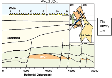
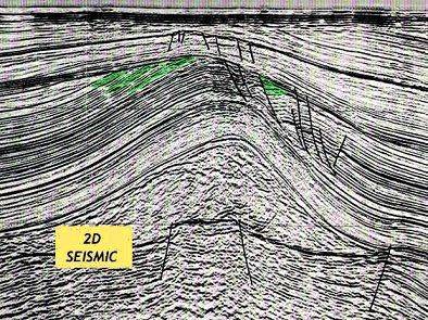
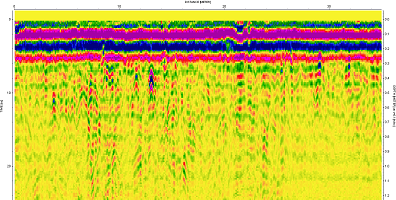
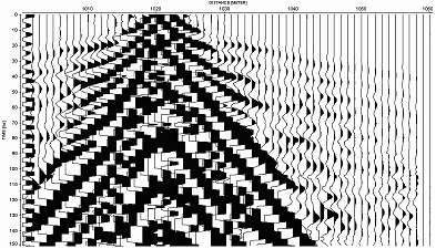
Seismic reflection Seismic refraction Petroleum reseroir vertical crosssection
Vadose zone flow simulation Archaelogical survey using GPR