Physical Geology Slides-Soils and Weathering
Steven Dutch, Natural and Applied Sciences, University of Wisconsin - Green Bay
First - time Visitors: Please visit Site Map and
Disclaimer. Use "Back" to return here.
Weathering Phenomena
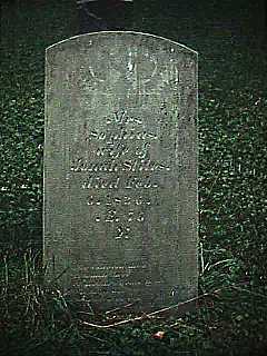 |
Studies of rock weathering are so popular that people
are just dying to participate. In a century and a
half, this slate headstone has scarcely weathered. Even
faint guide lines scribed by the stonecutter are still
visible. Near Syracuse, New York. |
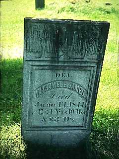 |
In roughly the same length of time, this marble
headstone has weathered appreciably. Lettering is rounded,
the surface is rough, and the stone is stained by organic
acids. (One of the James clan's distant relatives, named
Jesse, went west and became rather famous. Really.) |
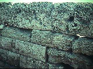 |
2500 years of exposure to salt air will do this to
marble. A wall at Cape Sounion, Greece. |
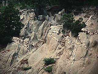 |
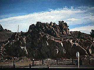
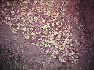
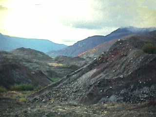
Rocks weather at different rates. The dark gray rock,
rich in ferromagnesian minerals, is so crumbly it can be
dug by hand. The dikes and sills, mostly quartz and
feldspar, are much less weathered. San Bernardino
Mountains, California. |
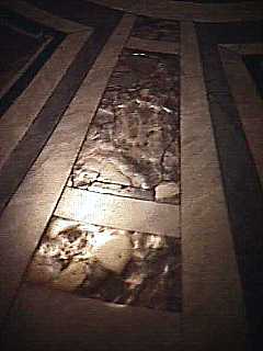 |
400 years of pedestrian traffic has differentially
eroded this marble floor in St. Peter's, in Rome. |
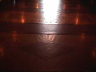 |
A century of foot traffic in the State Capitol, in
Madison, has resulted in noticeable differential wear. |
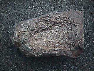 |
A rock from Saudi Arabia, showing exfoliation and
spheroidal weathering. |
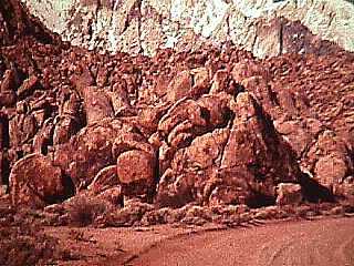 |
These granitic rocks at the base of Mount Whitney,
California, are spheroidally weathered. |
 |
This road cut in Colorado shows the relation between
spheroidal weathering and joints. Below ground level the
rocks are fresh and broken by joints into angular blocks.
Above ground level the blocks are rounded by spheroidal
weathering. |
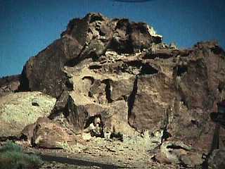 |
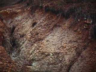
In desert environments, moisture lingers under rocks,
causing them to weather from below. The dark patina,
called desert varnish, is actually a very complex product
of chemical weathering and microbial action. Calico,
California. |
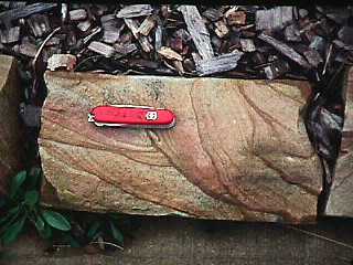 |
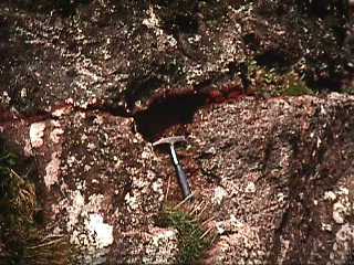
These look spectacular but actually have little known
geological significance. The color bands, called Liesgang
Rings, are due to iron oxide transported through the
rock by water. |
Soil Types
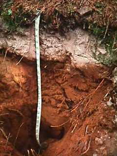 |
A typical soil profile, a spodosol from Menominee
County. Thin organic debris (O horizon) caps the soil.
Organic acids help dissolve materials out of the A
horizon, creating a bleached zone of pure white quartz
sand. Beneath is the brilliant orange B horizon where
iron accumulates. Spodosols are typical soils of conifer
forests. |
 |
Scenes like this are common during the spring plowing.
The variations in soil color are partly due to more
drainage and oxidation in the high spots, but chiefly due
to scalping. Soil is plowed and eroded off the high spots
and deposited in the low spots, so that the B horizon
shows through in the high spots of the fields. The very
dark area is freshly plowed, still-moist soil. |
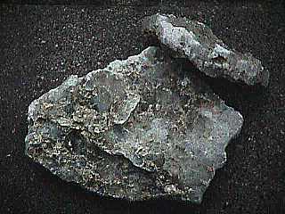 |
In arid climates, calcium dissolves out of the A
horizon only to reprecipitate as calcite or gypsum in the
B horizon. This gypsum came out of an Iraqi foxhole in
Kuwait. It must have been tough to dig. Serves them right.
|
 |
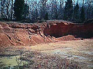
Very old temperate soils like this outside Birmingham,
Alabama are called ultisols (ultimate soils). The
pebbles are chert, all that remains of the limestone that
once existed here. Unweathered bedrock is exposed at the
bottom of the 2-meter deep gully. |
 |
This ultisol, in central Tennessee, has had most of
its soluble components leached away but still preserves
the layering of the original bedrock. |
Fossil Soils (Paleosols)
 |
This is a typical oxisol or laterite, a very
old tropical soil, except this soil is in California. It
is also a paleosol, a fossil soil about 50 million
years old. Paleosols are rarely preserved because soils
form in areas of weathering and erosion. |
 |
Another paleosol, this one preserved between two lava
flows on the Isle of Skye, Scotland. By coincidence, this
one is also about 50 million years old. |
Mass Wasting
Creep
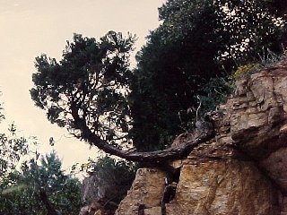 |
When soil creeps downhill, small trees tend to be
bent over, but also have a biological drive to grow
vertically (called geotropism). Thus, trees on creeping
slopes tend to curve at the base. |
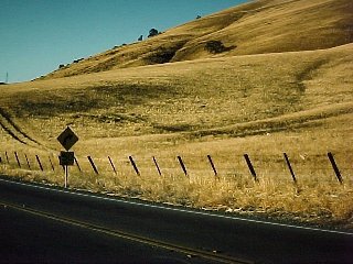 |
Fenceposts and telephone poles, on the other hand,
don't grow vertically and merely tilt on creeping slopes. |
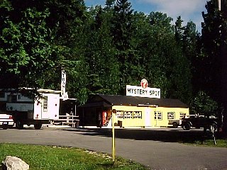 |
Almost every State has a "mystery spot"
where some strange force causes trees to be bent and
twisted, structures to slide downhill, and so on. Most of
the phenomena at these "mystery spots" can be
explained in terms of soil creep. |
 |
The loose rubble on the hillside is a product of
weathering and soil creep called colluvium. It
creeps downhill slowly but is not very securely in place
and can also give way as a debris flow if it becomes wet
enough. Near San Bernardino, California. |
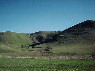 |
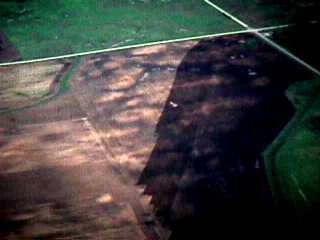
A virtual textbook of hillslope processes near
Livermore, California. A fresh mudflow can be seen as
well as several older landslide scars in varying states
of erosion. The fine horizontal terracing on the
hillsides was made by the hooves of grazing cattle. This
landscape was probably open grassland with scattered
trees before European occupation. |
Landslides and Avalanches
|
|
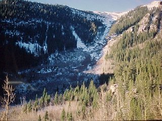 |
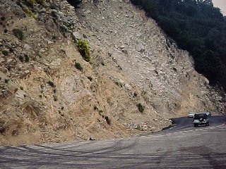
This gully in central Colorado has been scoured clean
by repeated snow avalanches. |
 |
The far end of the Mount Saint Helens avalanche. The
mounds are blocks of the mountain, but were literally
shaken to pieces as they moved and can be dug with a
shovel. |
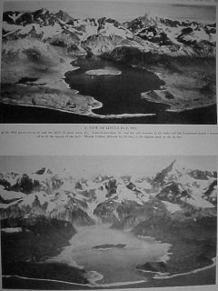 |
In 1958, a large earthquake shook a massive rock and
ice avalanche loose at the head of Lituya Bay, Alaska,
generating the highest wave ever documented. These photos
show the bay before and after the avalanche. There were
three boats in the bay and amazingly, two survived. One
of the survivors recalled looking down on 100-foot trees
as the boat was carried over the bar at the mouth of the
bay. Although the wave was immense in the small enclosed
bay, it rapidly dissipated to insignificant in the open
sea. |
 |
A view looking down on the area washed by the wave.
That's a mature forest of 200-foot Douglas firs and Sitka
spruces. |
 |
The water swept away a mature forest right down to
bedrock. The high water mark is 1,740 feet above sea
level. Water sloshed an additional 200 feet or so higher,
carrying debris into the forest but not uprooting it. |
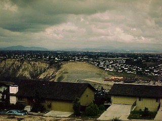 |
Your tax dollars at work. The depth of weathering is
visible in the distant cut. These homes (costing $200,000
and up) were built on landslide deposits. The landslide
deposits contain the ruins of the previous housing
development built here. Guess who pays for the disaster
relief when it happens again? |
Access notes on Soils and
Weathering
Return to Physical Geology
Notes Index
Return to Professor Dutch's Home Page
Created 13 July 1998, Last Update 28 May 2003
Not an official UW Green Bay site