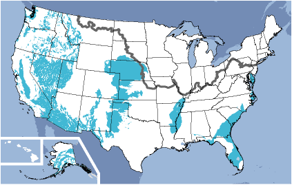
Regional unconsolidated aquifers can be grouped into basin fill alluvial aquifers and blanket alluvial aquifers. Aquifer thickness ranges from a few meters or tens of meters in the blanket sands along the eastern Atlantic coast of the United States to several hundred meters in the basin-fill aquifers of the southwestern United States.
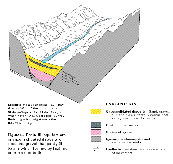
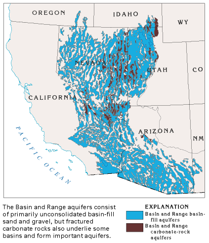
Basin-fill aquifers consist of sand and gravel deposits that partly fill depressions which were formed by faulting or erosion or both . These aquifers are also commonly called valley-fill aquifers because the basins that they occupy are topographic valleys. Fine-grained deposits of silt and clay, where interbedded with the porous sand and gravel, form confining units that retard the movement of ground water. In basins that contain thick sequences of deposits, the sediments become increasingly more compacted and less permeable with depth. The compacted, lithified deposits form sedimentary rocks. The basins are generally bounded by low-permeability igneous, metamorphic, or sedimentary rocks.
Blanket alluvium is deposited by streams and rivers that spread out over large plains. These may be alluvial fans at the base of mountain ranges, extensive flood plains formed by the meandering of large rivers, or outwash deposited at the terminal extent of a glacier. They are typified by their greater extent and lesser thickness, as compared to valley or basin-fill aquifers.
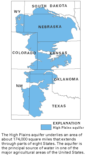
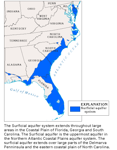
The High Plains (Ogallala) Aquifer is an example of an Alluvial Fan Aquifer. As the Rocky Mountains were uplifted, eroded sediment was deposited over the central plains. A similar process created the East Coast Surficial Aquifers along the eastern Coast. The sediments were deposited mostly in shallow marine environments when sea level was higher relative to the land surface than at present, or in the floodplains and deltas of rivers that drained the landmass to the north and west.
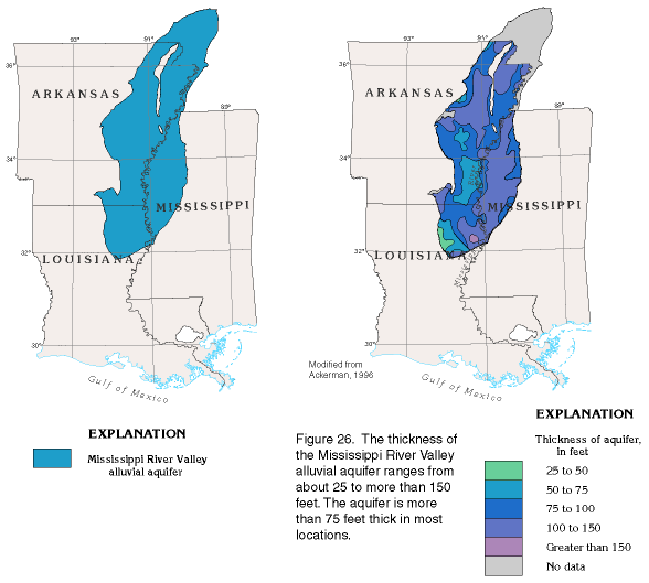
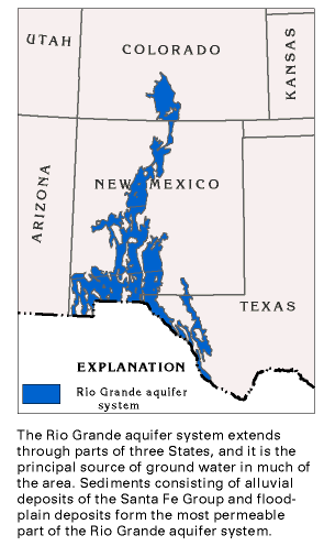
The Mississippi River and Rio Grande River Alluvial Aquifers are formed by the meandering of these great rivers over wide valleys. The permeability of these sediments vary, but there are large extents of sand and gravel associated with both systems. Parts of the Rio Grande Aquifer are heavily utilized by growing populations. The water table in the aquifers tapped by the city of Albuquerque, New Mexico, for example, is declining at a rate of almost 10 feet per year.