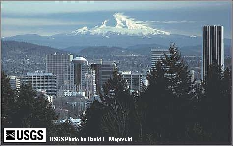
Snow-clad Mount Hood (3,426 meters - 11,239 feet) dominates the Cascade skyline from the Portland metropolitan area to the wheat fields of Wasco and Sherman Counties. The mountain contributes valuable water, scenic, and recreational resources that help sustain the agricultural and tourist segments of the economies of surrounding cities and counties. Mount Hood is also one of the major volcanoes of the Cascade Range, having erupted repeatedly for hundreds of thousands of years, most recently during two episodes in the past 1,500 years. The last episode ended shortly before the arrival of Lewis and Clark in 1805. When Mount Hood erupts again, it will severely affect areas on its flanks and far downstream in the major river valleys that head on the volcano. Volcanic ash may fall on areas up to several hundred kilometers downwind. Mount Hood was named after a British admiral, Lord Samuel Hood, and first described in 1792 by William Broughton, member of an expedition under command of Captain George Vancouver. -- Scott, et.al., 1997, and Swanson, 1989
Mt. Hood volcano is located in an area with many complex structural features (see figure 1). The volcano sits atop a swell that runs north-south through the Cascade Range in Oregon. Within this swell is a graben that is bounded to the east by the Hood River Fault and and a series of smaller faults to the west(light solid lines in figure 1). Superimposed on the High Cascades Graben is the Mount Hood Subsidence block (shown by the heavy solid lines in figure 1). In addition, there are several right-lateral strike slip faults that trend Northwest-Southeast (light dashed lines in figure 1) and many anticlines and synclines that vary in trend (crosses on figure 1).
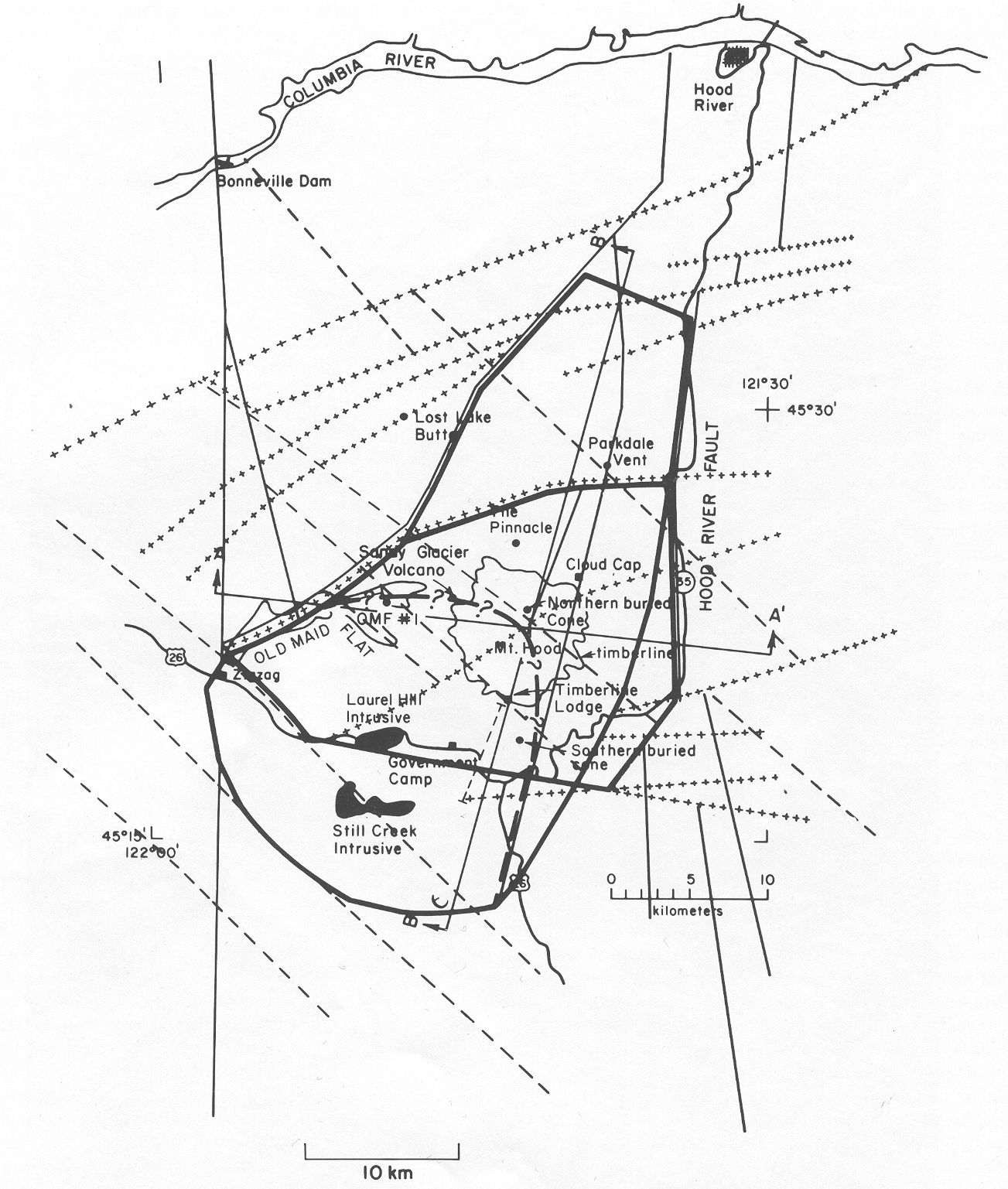
Figure 1: Structures in the Mount Hood Region. Light solid lines
represent the High Cascades Graben, Heavy solid lines show the Mount Hood Subsidence
Block, dashed lines represent the NW-SE trending dextral strike slip faults
and the crosses show the locations of anticlines and synclines. Click the image
to enlarge.
The two cross-sections (A-A' and B-B') are shown below in Figure 2.
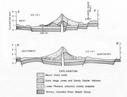
Figure 2: Cross-sections across the Mount Hood region showing the structure.
Since about 30,000 years BP, Mt. Hood has experienced several episodes of activity. Between 30,000 and 15,000 years BP., there were multiple episodes of lava flow and dome emplacement that was accompanied by pyroclastic fall and flows, and volcanic mudflows down all flanks of the volcano. After a quiescence of about 13,000 years, activity again occurred, this time characterised by a large debris avalanche (or landslide) that originated on the SW flank of the volcano, creating a distinctive horseshoe shaped caldera. There were also several smaller avalanches from several areas on the north flank of the volcano. Figure 3 shows the contrasting faces of the north and south flanks of Mt. Hood. During the last 200 years, there have been several minor episodes of activity that have included small explosions and ashfall, small pyroclastic flows and volcanic mudflows.
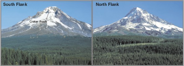
Figure 3; The contrasting flanks of Mt. Hood.
More information on the structure of the mount hood region can be found in the following article which will be available in class
Williams, D.L., D.A. Hull, H.D. Ackerman and M.H. Beeson, 1982, The Mt. Hood Region: Volcanic History, Structure and Geothermal Energy Potential, J. Geophysical. Research, Vol. 87 No.B4 pp 2767-2781
For more information on the volcanic history of mount Hood, the following USGS publications have been used
W.E. Scott, T.C. Pierson, S.P. Schilling, J.E. Costa, C.A. Gardner, J.W. Vallance, and J.J. Major, 1997, Volcano Hazards in the Mount Hood Region, Oregon: USGS Open-File Report 97-89
Cynthia A. Gardner, William E. Scott, Jon J. Major, and Thomas C. Pierson, 2000, Mount Hood -- History and Hazards of Oregon's Most Recently Active Volcano: U.S. Geological Survey Fact Sheet 060-00