Cattaraugus Formation (Clarke, 1902)
Lithology. The Cattaraugus Formation is comprised of interbedded shales, silty shales, shaly siltstones, siltstones and fine-grained sandstones. The Cattaraugus Formation is distinguished from the interbedded sections of the underlying Conneaut Group by the presence of red clastic material. The upper contact with the Oswayo Formation is marked by the transition from red interbeds with sporadic gray interbeds to gray shales and shalier interbeds with green-colored sandstone. The lowest stratigraphic transition from the normal gray interbeds to red interbeds occurs above the stratigraphic level of the Salamanca and Wolf Creek conglomerates. The red interbeds continue to alternate with gray interbeds and lensing sandstone packets. Within both the gray and red interbeds, the siltstone and fine sandstone beds commonly lens, with individual thin beds being traceable over 3 to 5 meters. Bedding within the interbeds is typically rippled cross-bedding, although in some red interbeds, all internal bedding is destroyed by bioturbation. Channels within the Cattaraugus Formation were common, with the typical channel being 2 meters wide and 0.4 meters deep. Within the red interbeds in the Olean quadrangle, siderite nodules were found in a 0.5 meter stratigraphic horizon. The nodules were 4 to 8 centimeters thick and approximately 20 to 30 centimeters in diameter. The sandstone packets within the Cattaraugus Formation do not contain red sands or shales and were relatively thin, approximately 0.5 to 1 meter thick. Bedding within the sandstone packets is typically SCS with less common beds of planar laminated sands. Outcrops in Allegany State Park and south of Olean, have sandstone packets that range in thickness of 3.5 to 3.9 meters. These thicker sandstone packets a coarser-
grained than the thinner packets observed in the Cattaraugus Formations, and contain a well-developed coarsening-upward sequence. The outcrop in Allegany State Park contains small lenses of conglomerate and a thin basal conglomerate bed, while the outcrop along Barnum Road, south of Olean contains thin lenses of coquinite typically not found in the thinner sandstone packets.
Ichnology. The gray interbeds contain a low diversity assemblage of Cruziana ichnofacies consists of Planolites and Thalassinoides. The sandstone packets contain a mixture of both Cruziana and Skolithos ichnofacies with abundant Planolites and Skolithos and less abundant Thalassinoides and Arenicolites. The red interbedded sections contain a high abundance Skolithos ichnofacies consisting of Skolithos and Arenicolites. The density of trace fossils is high enough to effectively destroy the original bedding.
Interpreted Depositional Environment. The presence of abundant red beds interspersed with small sandy channels is interpreted to represent the progradation of the alluvial plain. The presence of siderite nodules, commonly formed in soils, or in swamps and coal measures, suggest a terrestrial depositional environment, such as a flood plain. The small channels observed in the red interbeds were interpreted as being lateral accretion deposits formed by meandering tidal channels. The gray interbeds may reflect a more marine depositional environment such as intertidal depositional environment or possible a back-beach lagoon or bay. The thinner sandstone packets were interpreted to represent deposits from periodic storms, while the thicker sandstone packets observed in Allegany State Park and along Barnum Road, south of Olean were interpreted to represent occurrences of storm-influenced, progradational barrier bars.
Cattaraugus Formation
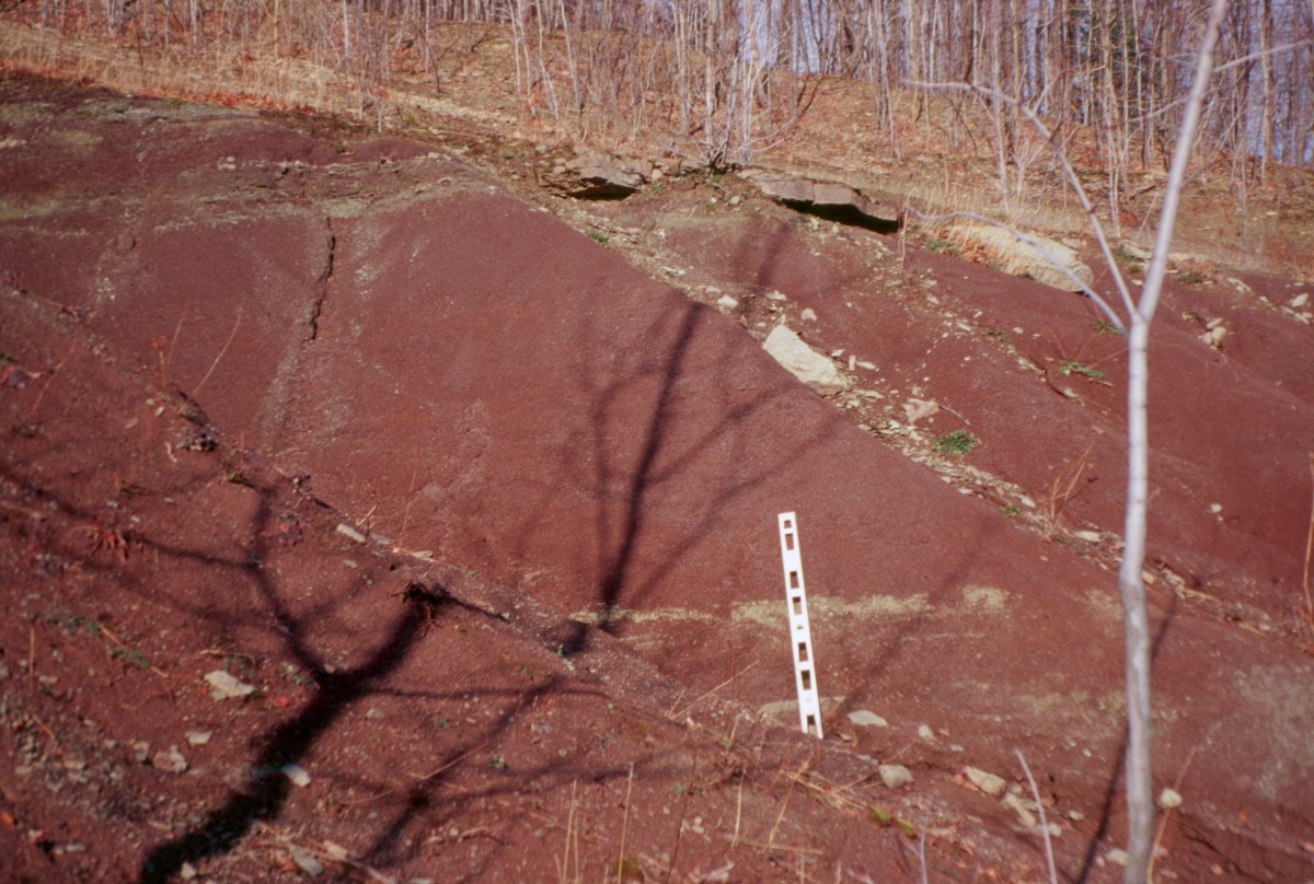
Cattaraugus Formation in outcrop along Rt 16 in the Olean 7.5 topographic quadrangle.
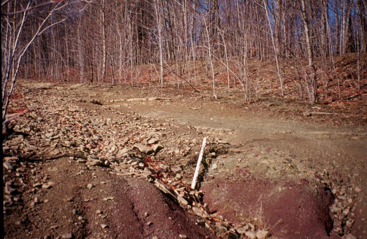
Cattaraugus-Oswayo contact along Rt 16., the transition here is fairly uninteresting but along the Pennsylvania/NewYork border the contact is erosive with large Oswayo sandstone unconformably overlying the red shales.
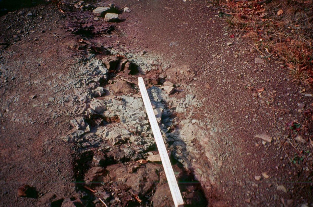
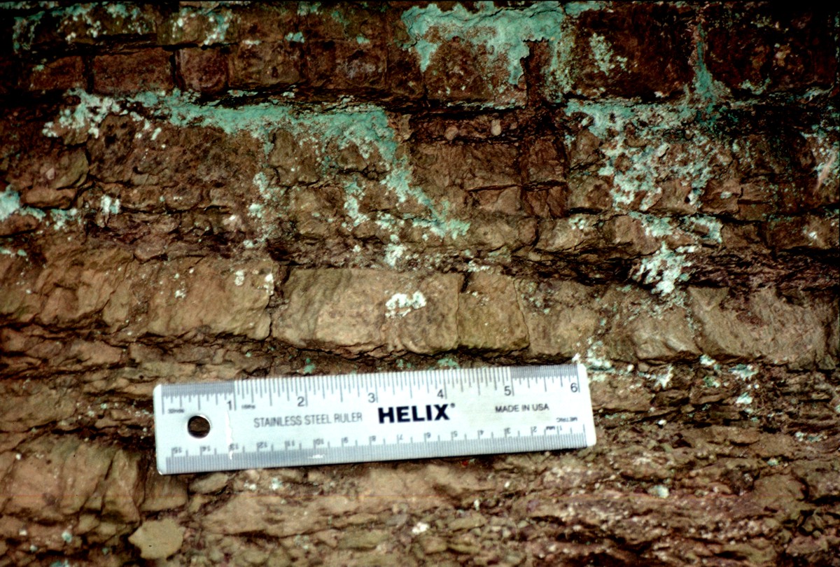
Iron stained (sideritic?) concretions found within the Cattaraugus Fm.
Red sandstone and shales of the Cattaraugus Fm. at an outcrop along Chapel Hill Rd., in the Humphrey quadrangle.
Numerous Skolithos and Arenicolites burrows in the sandstones of the Cattaraugus Fm.
have effectively destroyed all bedding within the sandstone at an outcrop along Chapel Hill Rd.
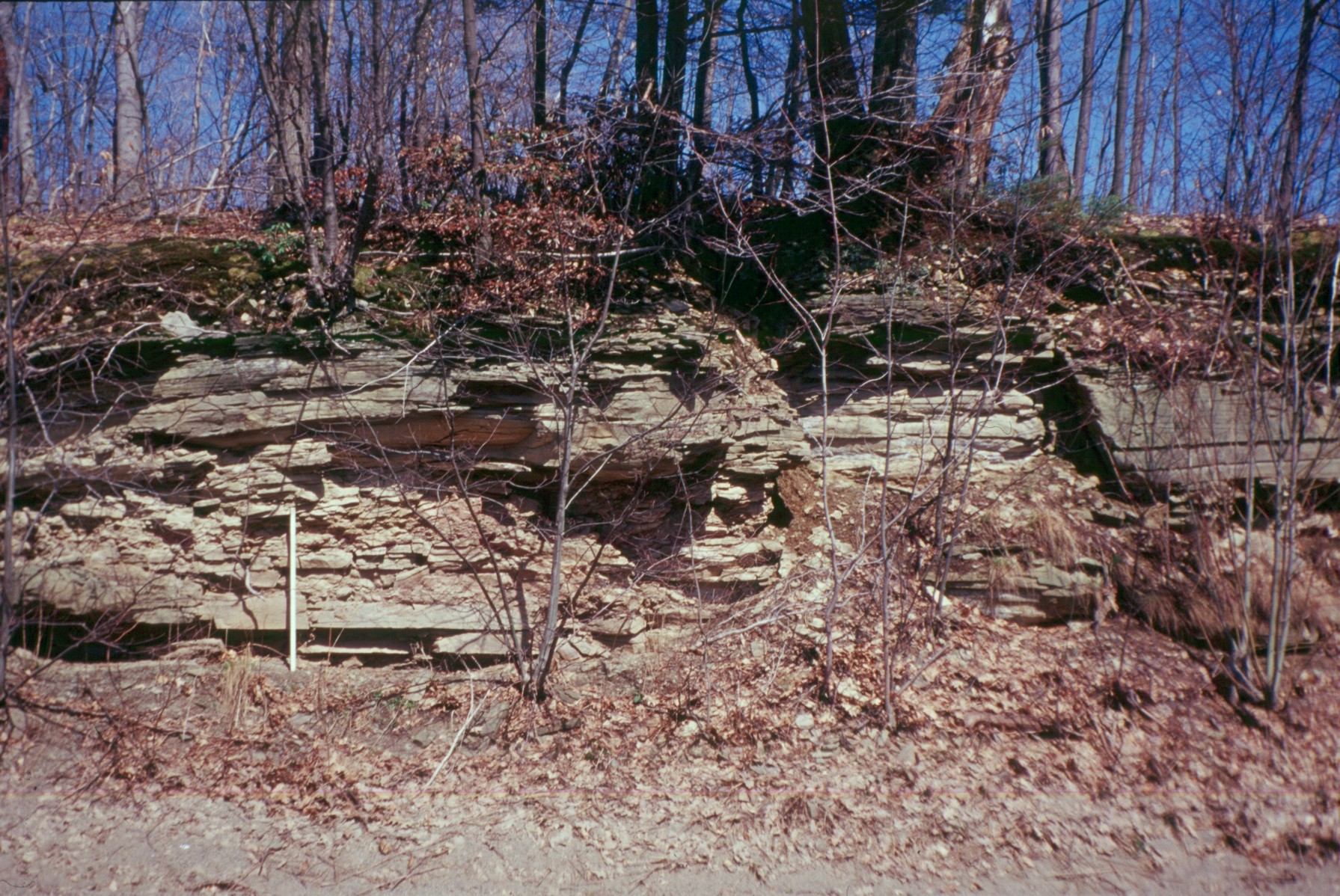
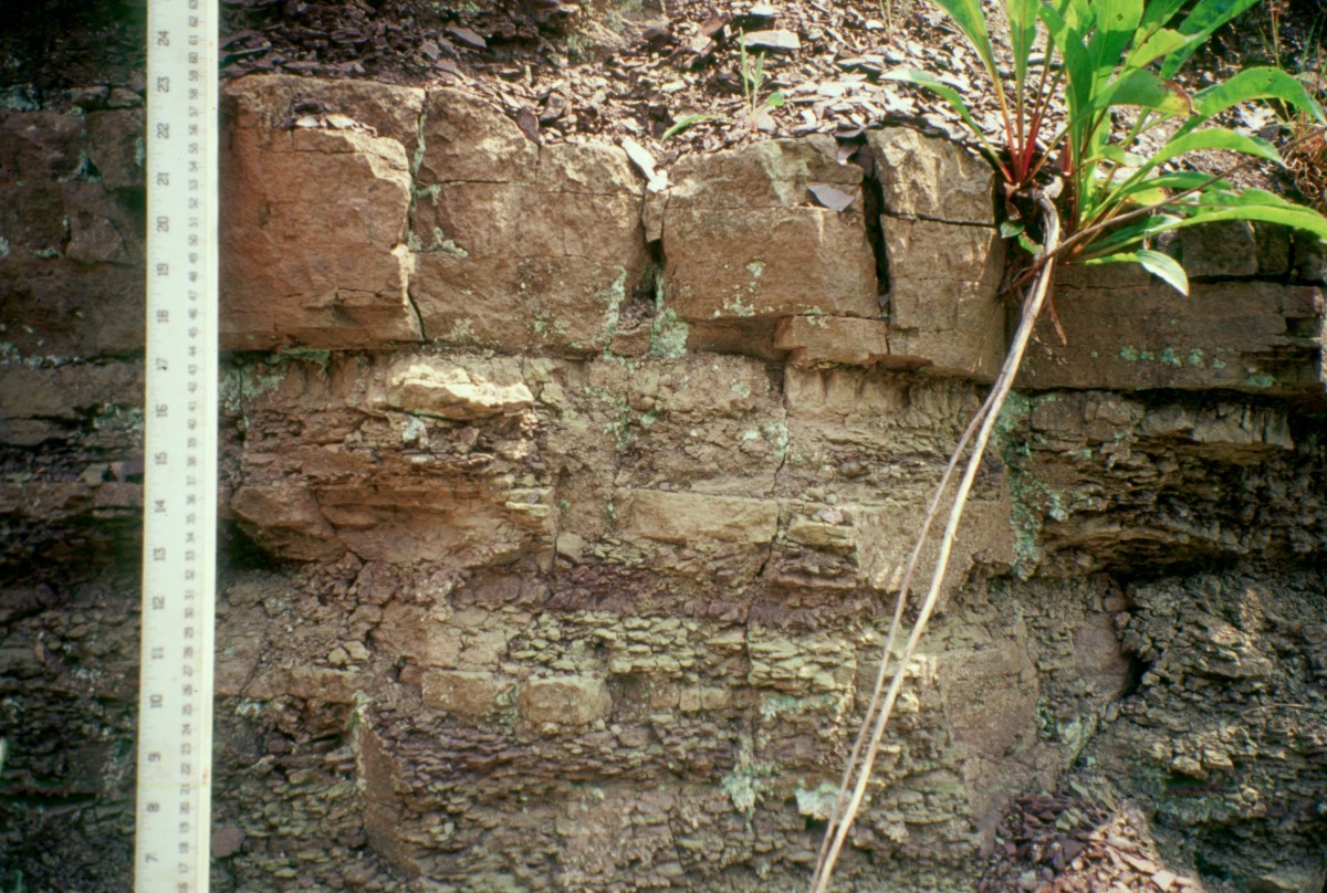
Thick sandstone bed in the Cattaraugus Fm., outcrop along Barnum Rd., Olean quad.