The majority of sedimentologic and stratigraphic research is based on Upper Devonian sediments located in southern Western New York. Past work focused on the area of northern Allegany County; recent studies have moved westward to Cattaraugus County. The objective of our research has been to study the effects and interplay of faulting/local tectonics on the deposition and preservation of clastic sediments. Projects have included determination of location and seismic potential of faults and faults zones related to the Clarendon-Linden Fault System, analysis of depositional environments, ichnology and sequence stratigraphy of the Famennian-age sediments of western New York State comprising the Canadaway, Conneaut and Conewango groups. Also, as part of the USGS and New York State Museum’s state mapping project, we have geologically mapped 11 7 ˝’ topographic quadrangles covering the northern boundaries of Cattaraugus and Allegany counties. Additional sedimentological and stratigraphical work is being performed in the Finger Lakes, primarily tracing marker beds to corroborate structures determined from remote sensing, geophysics and structural mapping.
Current research –
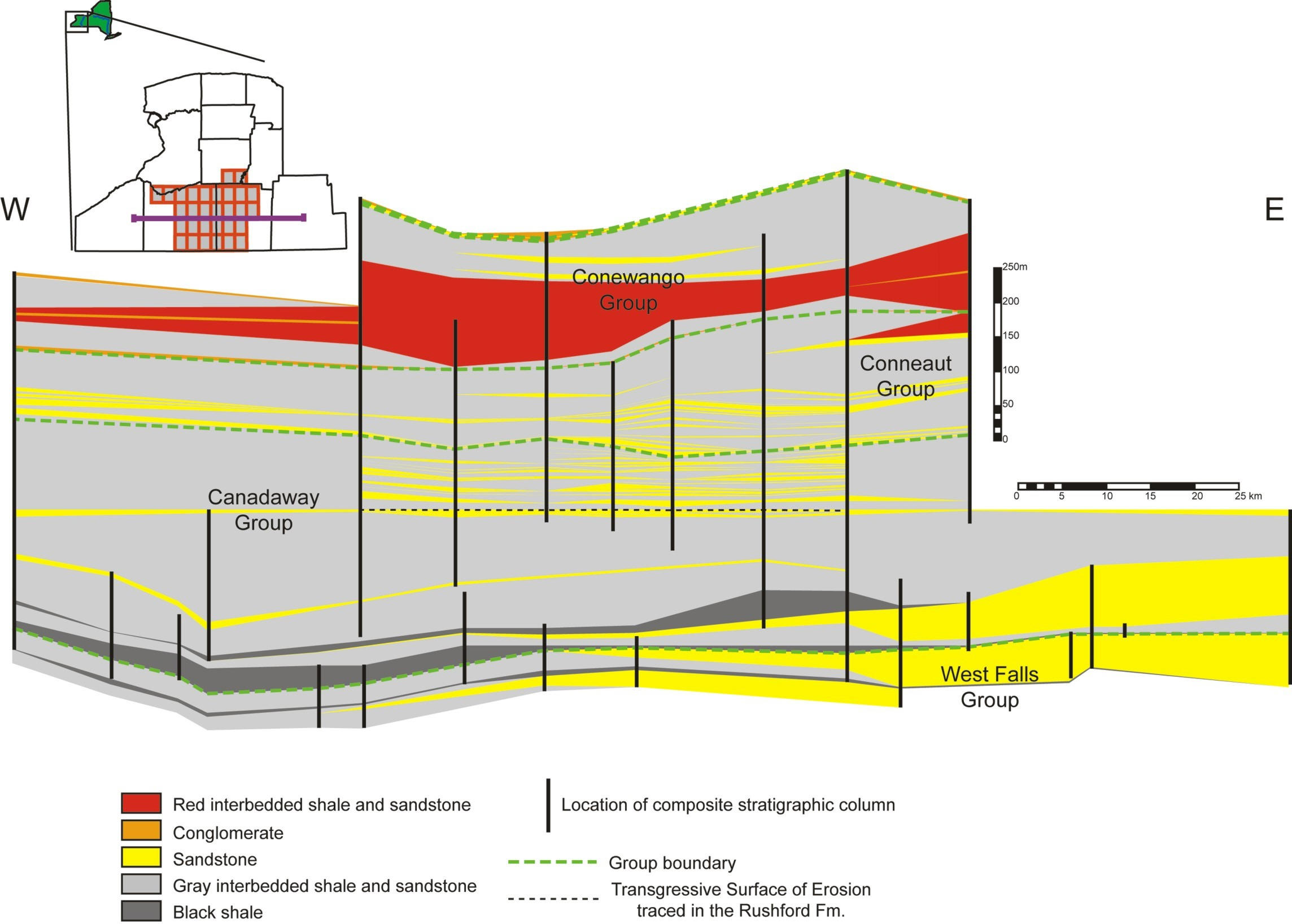
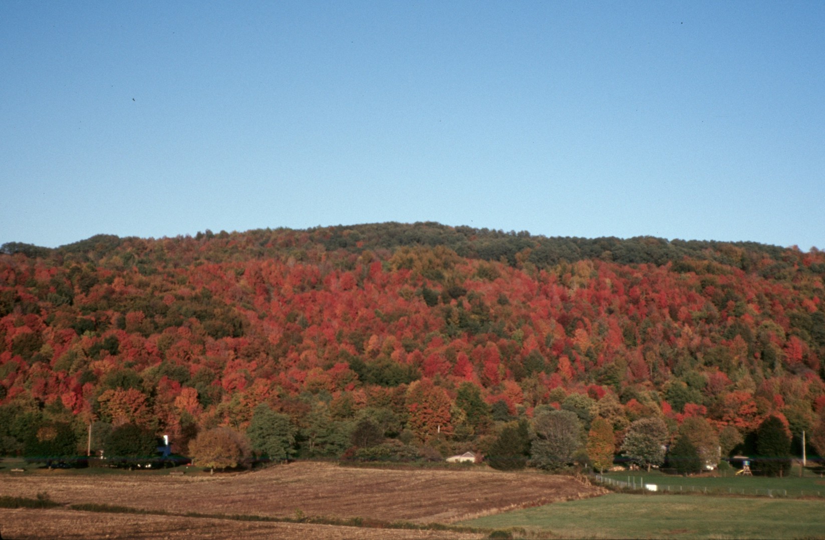
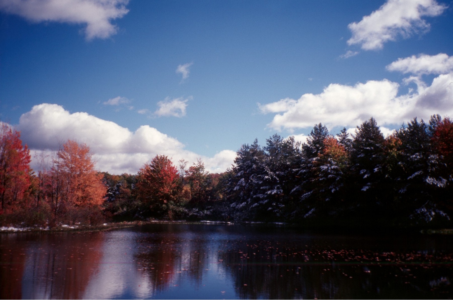
The following visual overview of the stratigraphy southwestern New York State is the product of fieldwork and data analysis by Robert Jacobi and Gerald Smith from 1990 onward. Shown are typical exposures of the major formations as well as sedimentological structures commonly observed, and our interpretation of the depositional environments of the various formations. Lithologic cross-sections depict the correlation of units at scales ranging from several hundred meters to over a hundred kilometers. For more information, consult the references at the bottom of the page.
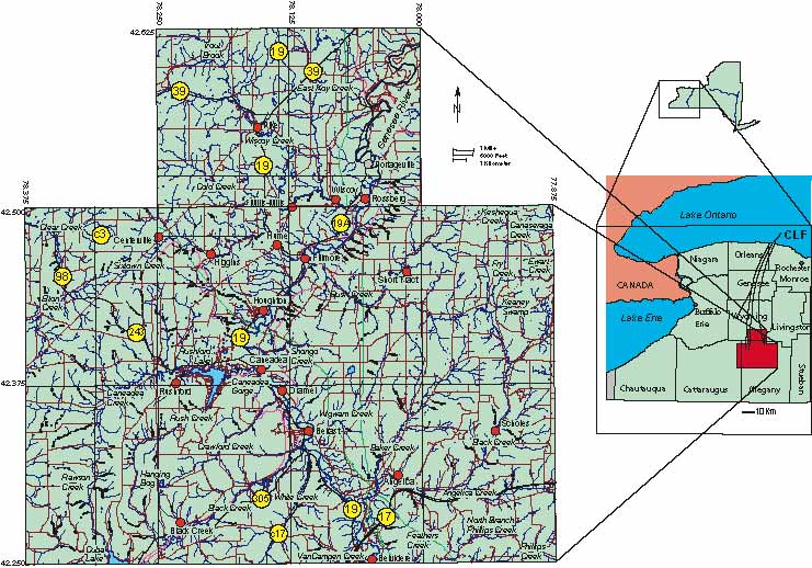
Location of the Clarendon-Linden Study field area. Enlarged map of western New York shows the location of the field area relative to the Clarendon-Linden Fault System (CLF); inset on left displays the towns and roads of northern Allegany County for geographical reference.
Location of the field area. Enlarged map of western New York shows the location of the field area relative
to the Clarendon-Linden Fault System (CLF); inset on left displays the locations of sites where outcrops were measured.
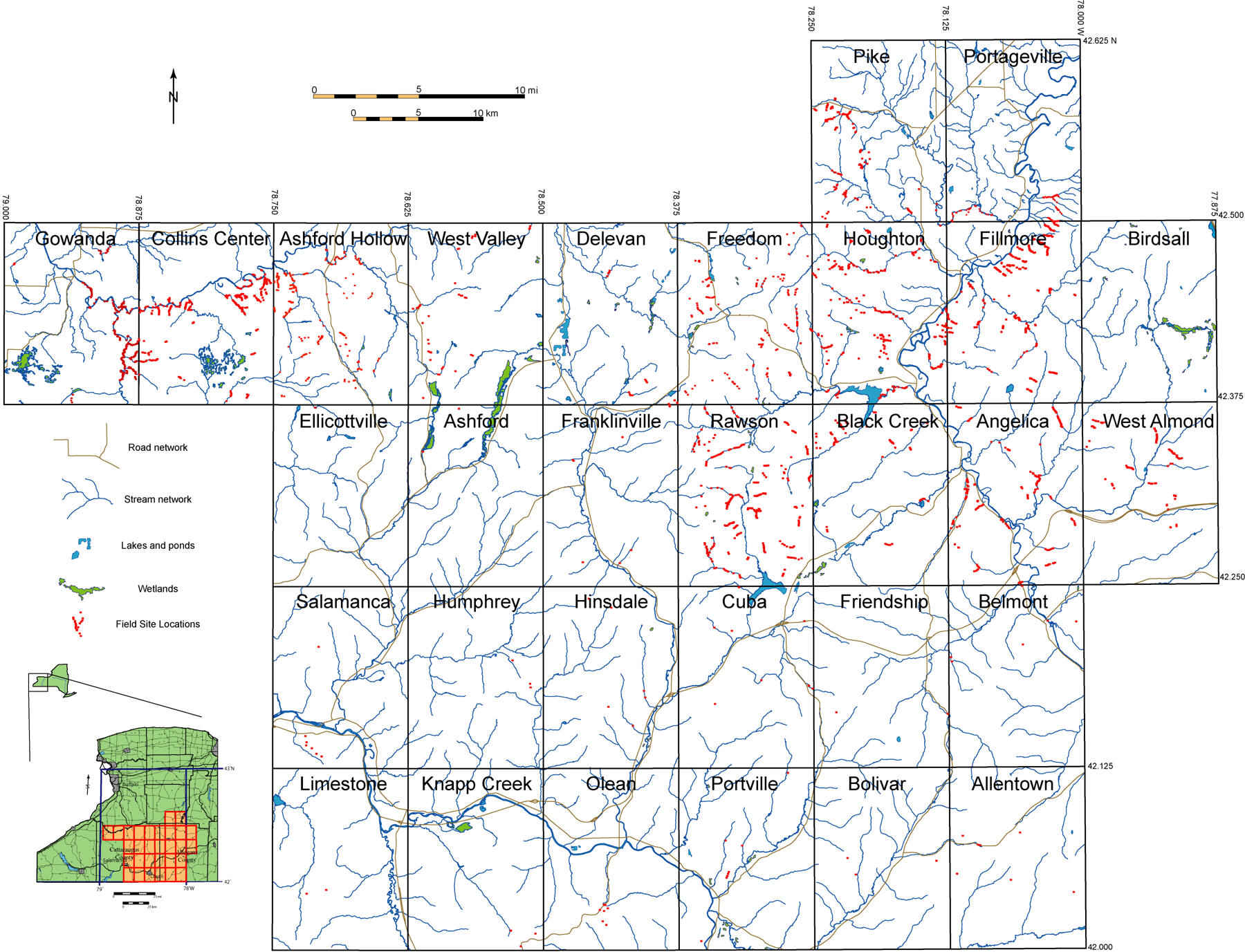
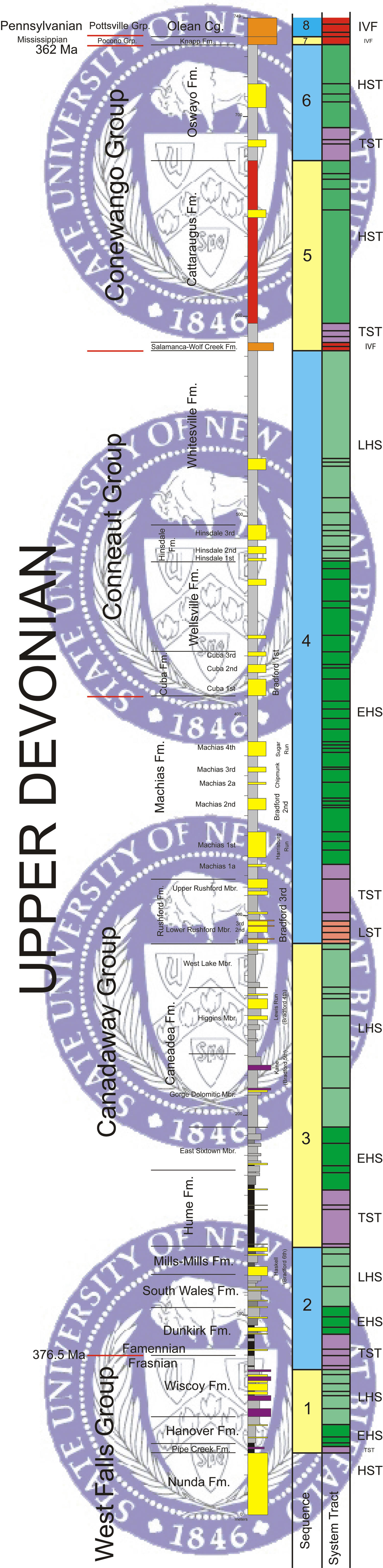
Below is our composite sequence stratigraphic column for the Upper Devonian sediments of the Allegany-Cattaraugus County Region displaying the lithologies and sequence stratigraphic interpretations for the entire Famennian Period. This column is based upon sedimentological data collected from outcrop; the location of the visited field sites is shown in the map above. Along the right side of the stratigraphic column we have placed the names of the major oil sands adjacent to the sandstones with which we correlate them with.
Click Here for the Info on the Olean Conglomerate
Click Here for the Info on the Knapp Fm
Click Here for the Info on the Oswayo Fm
Click Here for the Info on the Cattaraugus Fm.
Click Here for the Info on the Salamanca Conglomerate
Click Here for the Info on the Whitesville Fm.
Click Here for the Info on the Hinsdale Fm.
Click Here for the Info on the Wellsville Fm.
Click Here for the Info on the Cuba Fm.
Click Here for the Info on the Machias Fm.
Click Here for the Info on the Rushford Fm.
Click Here for the Info on the Caneadea Fm.
Click Here for the Info on the Hume Fm.
Click Here for the Info on the Mills-Mills Fm.
Click Here for the Info on the South Wales Fm.
Click Here for the Info on the Dunkirk Fm.
Click Here for the Info on the Wiscoy Fm.
Click Here for the Info on the Nunda Fm.
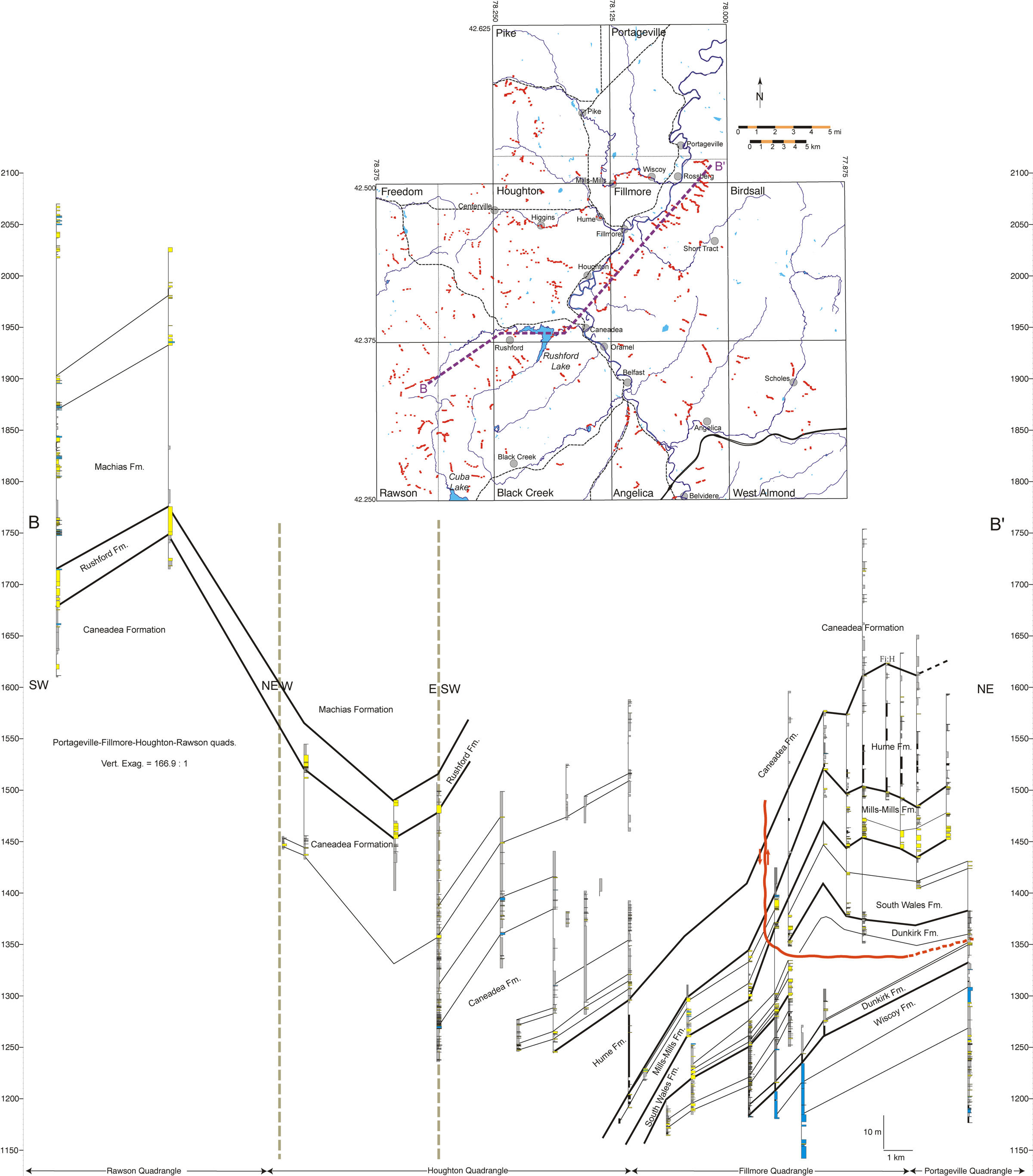
Cross-section along Wiscoy Creek
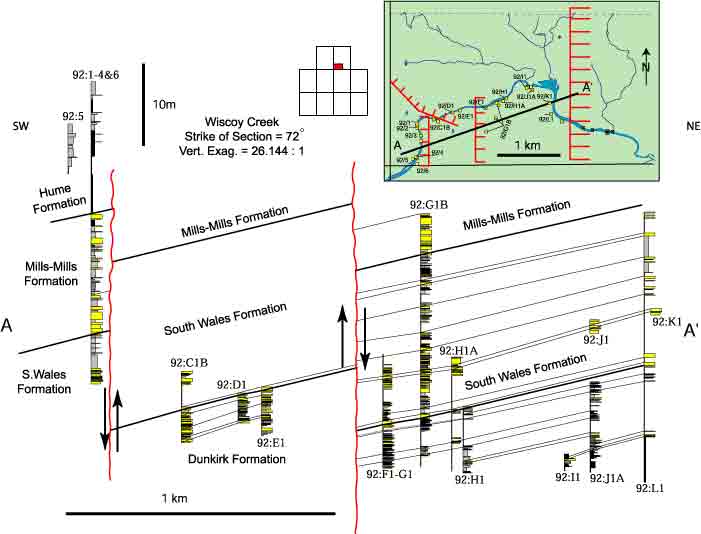
Cross-section A-A’ made along Wiscoy Creek. All stratigraphic sections were
measured at the millimeter scale and allow high-resolution stratigraphy.
Click Here to View Figure for Depositional Facies of the
Upper Devonian Acadian Foreland Basin
All Photos & Figures By Smith & Jacobi