Open ArcScene and create a new map. Save the map as MachiasScene. Arrange the windows so that both ArcCatalog file tree and the ArcScene file trees are visible. Expand the file tree for the raster catalog in ArcCatalog. Use the catalog to locate those NAPP images that overlay the clipped DRG. Drag and drop them into the ArcScene File window. You may incounter warnings about a difference in spatial coordinates. Acknowledge those warnings as OK.
Now drag the DRG file itself into ArcScene, and finally the two DEM files.
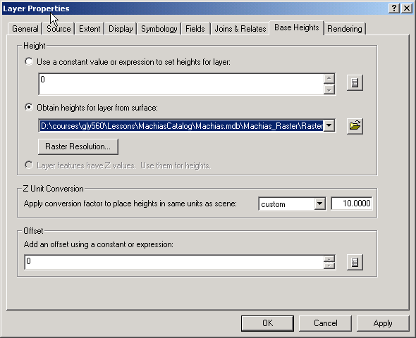
Open the properties dialog for the DRG dataset. Go to the Base Heights tab and choose to Obtain heights from a layer surface. Use the dropdown list to find the delevan DEM. Set the Z unit conversion to a manual value of 10. This will create a vertical exaggeration factor of 10.
Click OK. You should see the DRG has been "draped" over the DEM. The contours of the DRG should match the perceived elevation. The DEM itself will not change.
Pick a view that you like and export this scene to an image to be turned in.
Now use drap the two NAPP digital ortho images over the DEM using the same vertical exaggeration. Make sure you drap the image over the corresponding DEM (West Valley or Delevan)
Pick a view that you like and export this scene to an image to be turned in.
Create a web page that describes the DRG and the Orthoquad scene. Give details concerning the DRG and the Orthoquad data, extracted from the information given in the lesson. Explain what the viewer is seeing and include information about the direction the viewer is looking. What would you want to know if you were looking at this scene? The large lake, by the way, is called Lime Lake.
<<Last>>