Sedimentology and Stratigraphy
Hume Formation (Pepper and deWitt, 1951):
Type Locality:
Mills-Mills (Hume Township), NY
Equivalent Names:
none
Thickness:
36.6 m (~120 ft)
Lithology:
The Hume Formation is characterized by interbedded black siltstones and shales
with thin sandstones occurring near the top of the formation. Large (diameter
or long axis > 1 meters), calcareous concretions with septaria are common in the
Hume Formation. Deformed bedding around the concretions and formation of
septaria, indicate that the concretions formed early in the deposition of the
Hume Formation: before compaction of the shales. Unlike the Dunkirk Formation,
the Hume Formation units are predominantly cross-laminated. The basal contact
is sharp with black shales and siltstones overlying the gray shales and thick
sandstones of the Mills-Mills Formation. The upper contact is gradational with
gray shales, siltstones and thin sandstones interbedded with black shales and
siltstones. The field contact is placed at the first appearance of a thick (~30
cm) sandstone which has straight crested ripples. Thin bentonite beds occur in
the unit. Thin, fine-grained sandstones near the top of the formation contain
HCS.
Ichnology:
Trace fossils are not common; those present tend to be Planolites of the
Cruziana ichnofacies. Occasional vertical burrows observed in the HCS
are likely to be escape structures due to the low abundance of these structures
and the occurrence only in the storm beds.
Depositional
Environment:
The black shales and siltstones with increasing abundance of thin sandstones
interbeds toward the top are interpreted to represent basinal to offshore
deposits. The Hume Formation represents a deepening in the depositional
environment from the lowstand fan observed in the underlying Mills-Mills
Formation. The Hume Formation is interpreted by us to represent a deepening of
the basin accompanied by restriction of both sediment-supply and oxygen levels.
To the west, the Hume Formation may become incorporated in the lower part of the
Gowanda Formation, as the Mills-Mills Formations pinches out.
Hume Formation
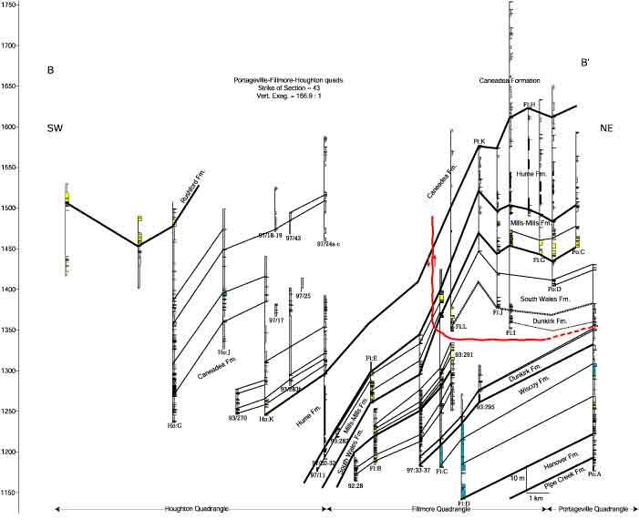
Cross-section B-B’ made from outcrops along the east side of the Genesee River.
This cross-section displays
the thickness doubling in the Hume Fm., that we attribute to northeast-striking
thrust faults.
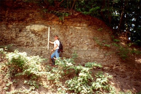
Type section of the Hume Fm. as defined by Pepper and deWitt (1951), along the roadcut at Wiscoy
Creek,
at Mills-Mills. Large carbonate concretions are typical through out the
formation. R. Bechtel for scale.
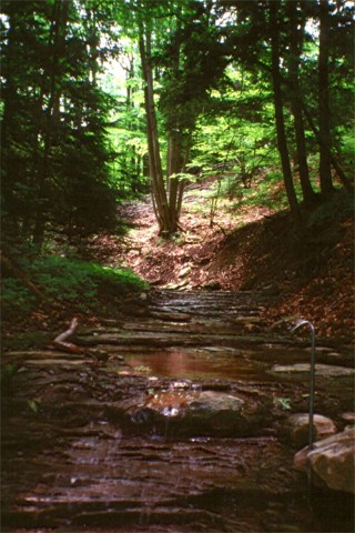
Typical outcrop of the Hume Fm. occurring in a small tributary along the east side of the Genesee River.
The black shales and carbonate concretions are well exposed. 92cm crowbar for scale.
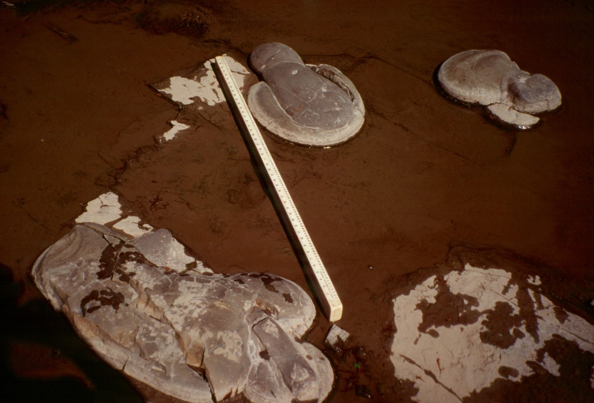
Ubiquitous
throughout the Hume Fm., large calcareous concretions (septarian nodules) grow
fairly large (~70cm
diameter on average) and sometimes in unusual overlapping
configurations as
seen here in the outcrop at Sixtown Creek.
Back to Sed-Strat Page