Rushford Formation (Luther, 1902):
Type Locality: Caneadea Gorge, Caneadea, NY
Equivalent Names: to the east --Towanda Fm.; to the west -- Shumla Fm., to the south -- Bradford Third Sandstone (Fettke, 1938; Woodruff, 1942; Harding, 1950; Manspeizer, 1963)
Thickness: 30.4 m (~99.7 ft)
Lithology: The Rushford Formation is characterized by two sandstone packets separated by interbedded gray shales and thin sandstones. Each of the sandstone packets ranges in thickness from 2 to 6 meters. The lower sand-packet can be divided into three shallowing cycles. The thick sandstones are massive to thickly bedded with amalgamation surfaces that are planer to slightly undulating. The Rushford Formation is primarily fine-grained sandstone; however, the lower sand-packet contains coarse-grained sandstone/conglomerate that occur as tabular beds which overlie each shallowing upward cycle and are separate from the fine-grained sandstone beds by a disconformity. Between the sandstone packets is a thick (2.3 – 16.3m) section of interbedded gray shales, siltstones and thin sandstones.
The shallowing cycles of the lower sand-packet are characterized by transitional bedding changes from tabular cross-sets at the base to trough cross-sets upsection to massive or planer and westerly (seaward) dipping subplaner beds at the top of the cycle. Conglomerate deposits contain steeply dipping cross-beds and trough cross-sets. In the interbedded section, thin sandstones contain HCS and 3D ripples (linguoids), and shell beds occurs sporadically with a very limited lateral extent. The upper sand-packet contains trough cross-sets, tabular cross-sets as well as HCS and swaly cross-sets (SCS) (Walker and Plint, 1992). Thin mud-drapes in the upper sand-packet were observed but not common. Towards the west, the upper sand-packet becomes finer-grained, and the inclusion of interbedded shales and siltstones occurred between the thicker sandstone beds, and in sites in the Ashford Hollow quadrangle, the individual sandstone beds were dolomitic.
The basal contact is defined as the base of the lowest thick sandstone of the Rushford Formation. The upper contact with the shales of the Machias Formation was rarely observed in the field, but is placed at the top of the upper sand-packet of the formation.
Ichnology: The thick sandstones of the Rushford Formation contain a low diversity Skolithos ichnofacies. The trace fossils are primarily Arenicolites, Skolithos and Thalassinoides. The trace fossil Macaronichnus occurs at one outcrop of the lower sandstone packet, near the top of one of the shallowing cycles. The presence of Macaronichnus implies a high energy, highly oxygenated environment that is common for foreshore or upper shoreface depositional environments. At the contact between the fine-grained sandstone and the conglomerate there a Glossifungites ichnofacies occurs that is comprised of Rhizocorallium, Arenicolites, Skolithos and Thalassinoides; trace fossils that indicate the presence of a firmground separating the sandstone from the conglomerate.
The interbedded shales, siltstones and thin sandstones contain a more prolific trace fossil assemblage dominated by Teichichnus but also contains sporadic Planolites, Palaeophycus, and Arenicolites.
Depositional Environment: The lower sandstone packet of the Rushford Formation is interpreted by to represent three stacked shoreface cycles that grade from upper offshore to foreshore environment. The conglomerates separated from the underlying shallowing upward cycles by a basal disconformity have been interpreted as transgressive lag deposits. The abundance of Teichichnus in the interbedded section overlying the lower sand-packet may indicate a deepening, such that the assemblage is equivalent to the Cruziana ichnofacies or the assemblage may indicate that the interbedded shales, siltstones and thin sandstones represent either lower shoreface to upper offshore environment or possibly brackish, low energy lagoon bay or deposits. Based on the predominance of trough-cross-sets, HCS, SCS and reversals in paleoflow directions, the upper sandstone packet can be interpreted to represent: 1) storm- and/or tide dominated lower shoreface deposits, 2) barrier bars or 3) storm-generated shelf sand ridges. Wide lateral variation in thickness of the upper sandstone packet favors interpretation of lenticular sandstone deposits as storm-generated shelf sand ridges.
Rushford Formation
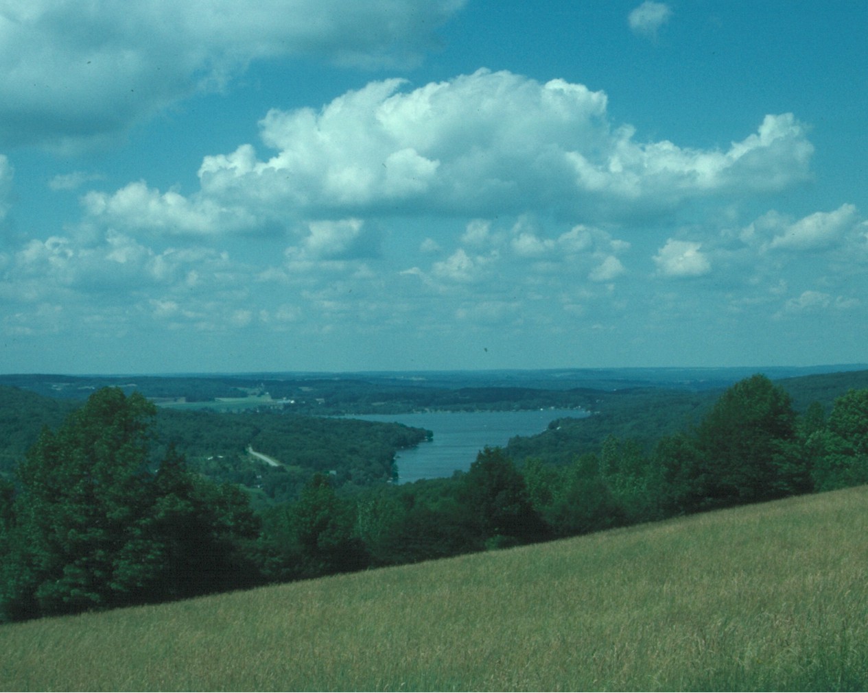
Rushford Lake seen from the top of Slusher Hill Rd.
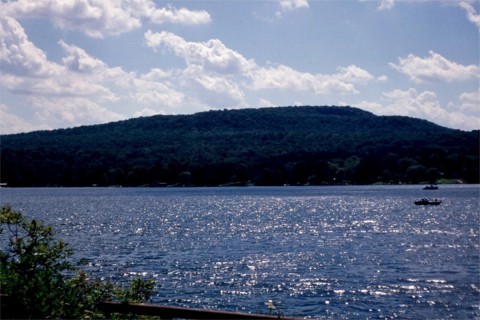
Rushford Lake.
Type locality of the Rushford Fm as defined by Luther (1902), at Rushford Lake during low water.
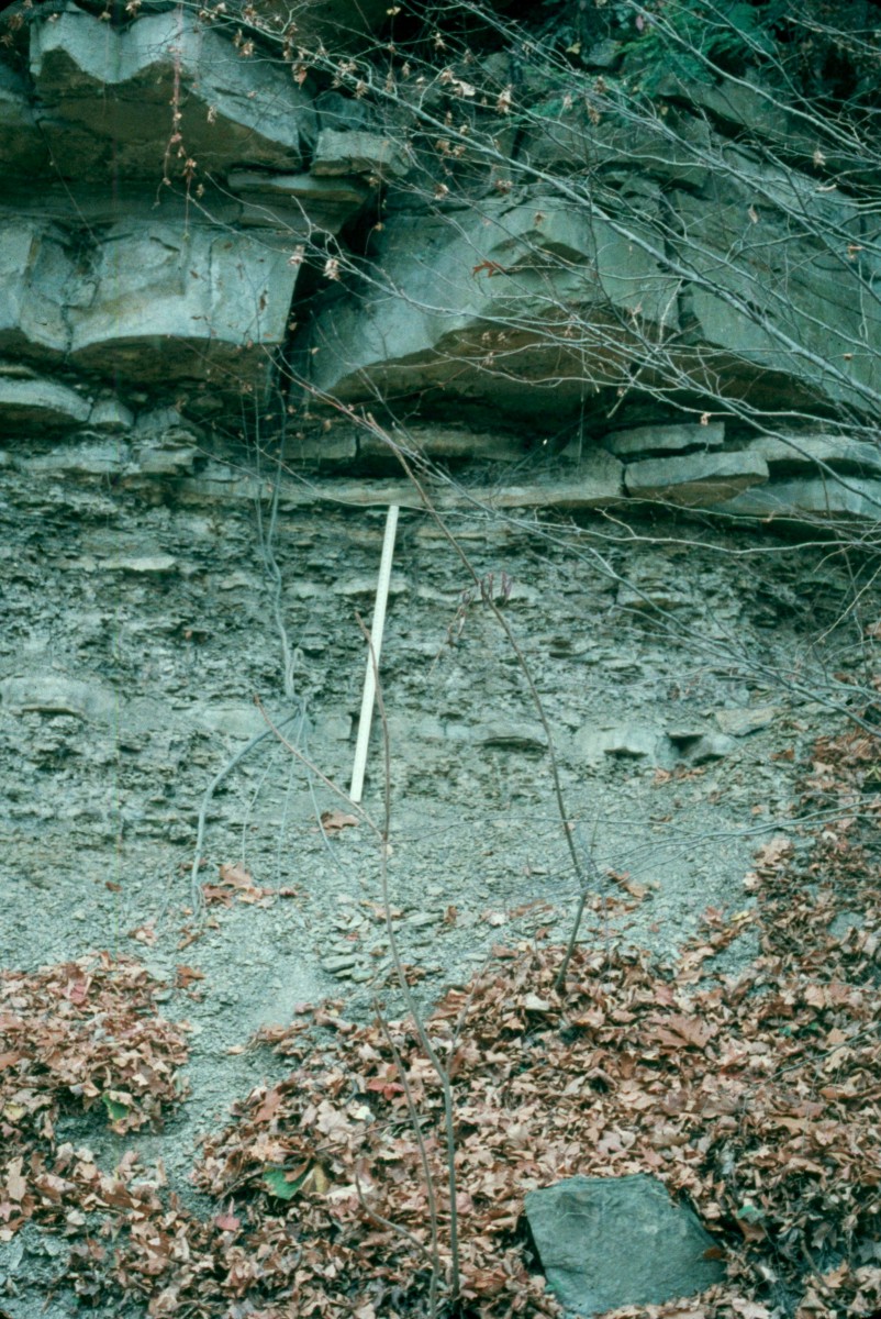
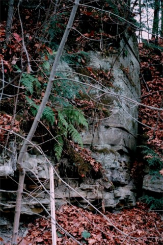
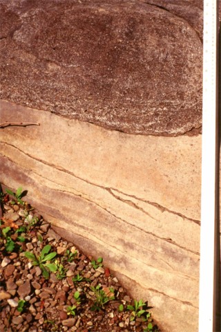
Rushford – Caneadea contact at outcrop along Hillcrest Rd., Houghton quadrangle.
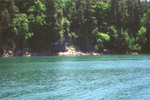
Outcrop of the Rushford Fm. along the west side of Rushford Lake along Hillcrest
Rd.,
exposure contains the lower sandstone packet. 121cm ruler for scale.
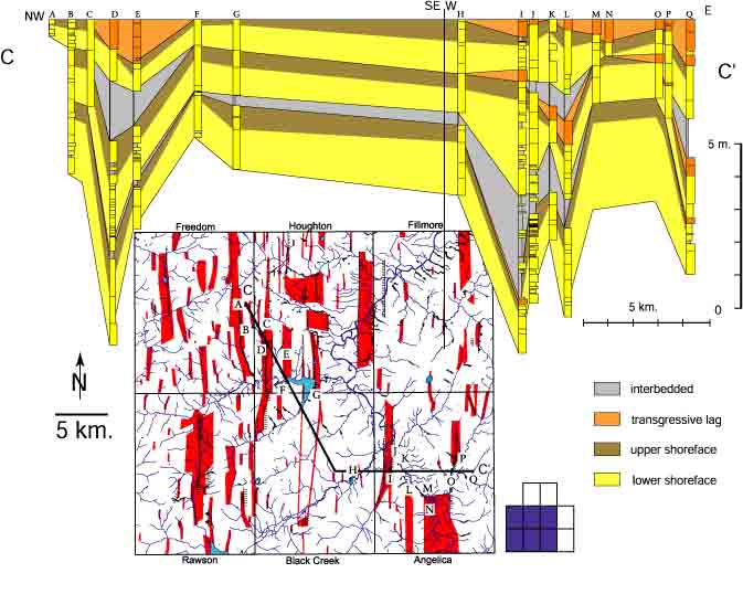
Cross-section C-C’ made from outcrops of the Rushford Fm. lower sandstone packet adjusted for dip.
Note that sections with thick interbedded lithofacies and transgressive lag deposits correspond to
areas of faulting (modified from Smith and Jacobi, 1998a).
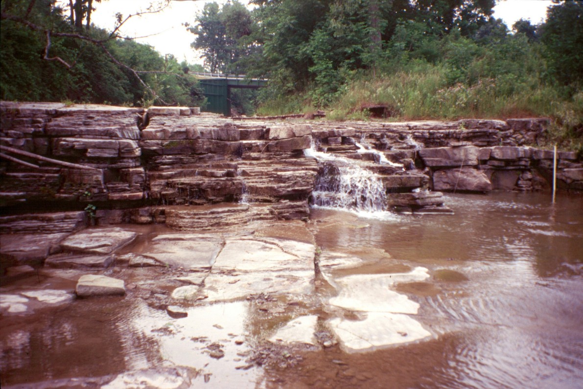
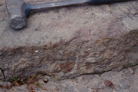
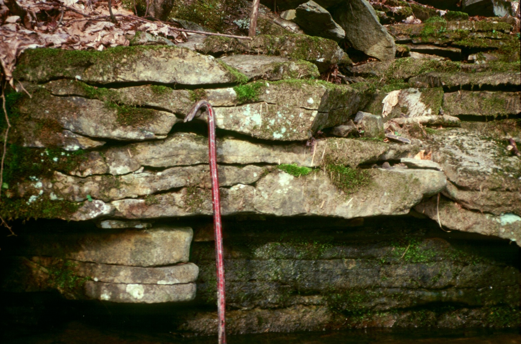
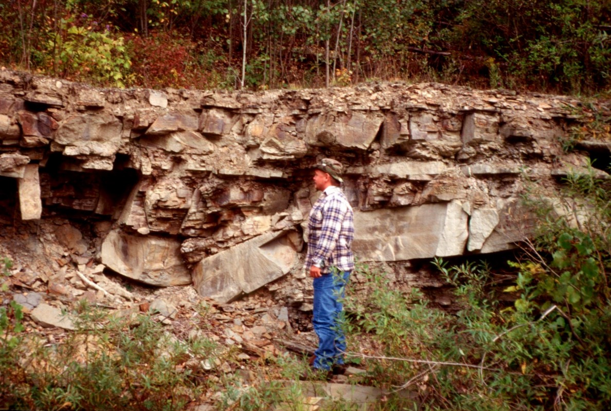
Roadcut exposing the lower sandstone packet of the Rushford Fm. along White
Creek.
Note that the thickness here is approximately 2.5x that of Hillcrest Rd. 121cm ruler for scale.
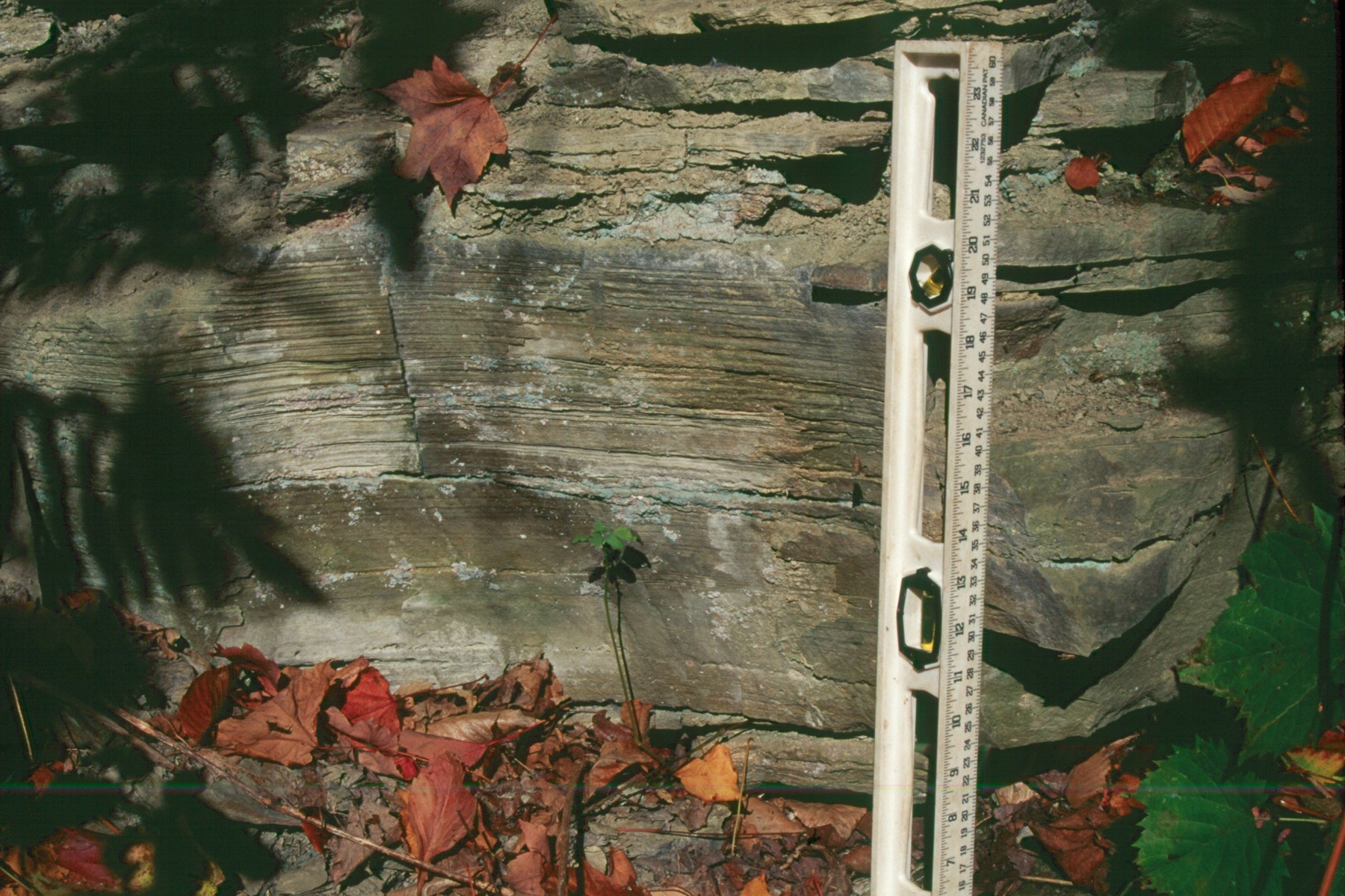
Exposure of the Lower Sandstone Member of the Rushford Fm. at an outcrop
along White Creek in the Angelica Quadrangle.
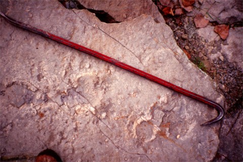
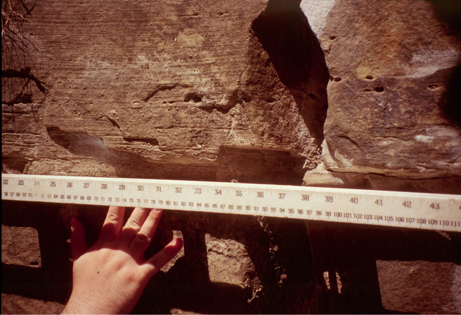
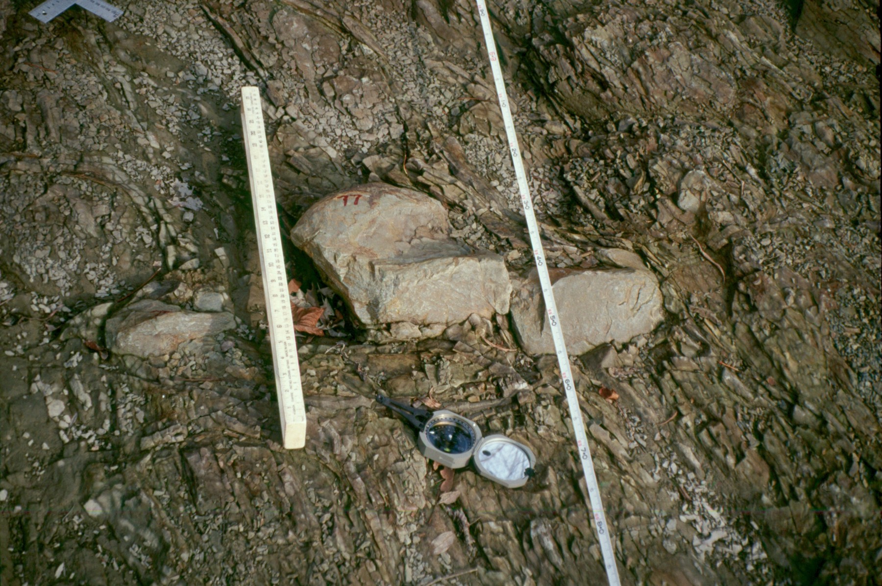
Rushford Fm., Rhizocorallium in sandstone bed beneath the transgressive lag. The presence of the Rhizocorallium
in an assemblage with Arenicolites and Thalassinoides indicates the presence of a Glossifungites firmground
and denotes a period of non-deposition, compaction and dewatering prior to the deposition of
the overlying lag deposits. 92cm crowbar for scale.
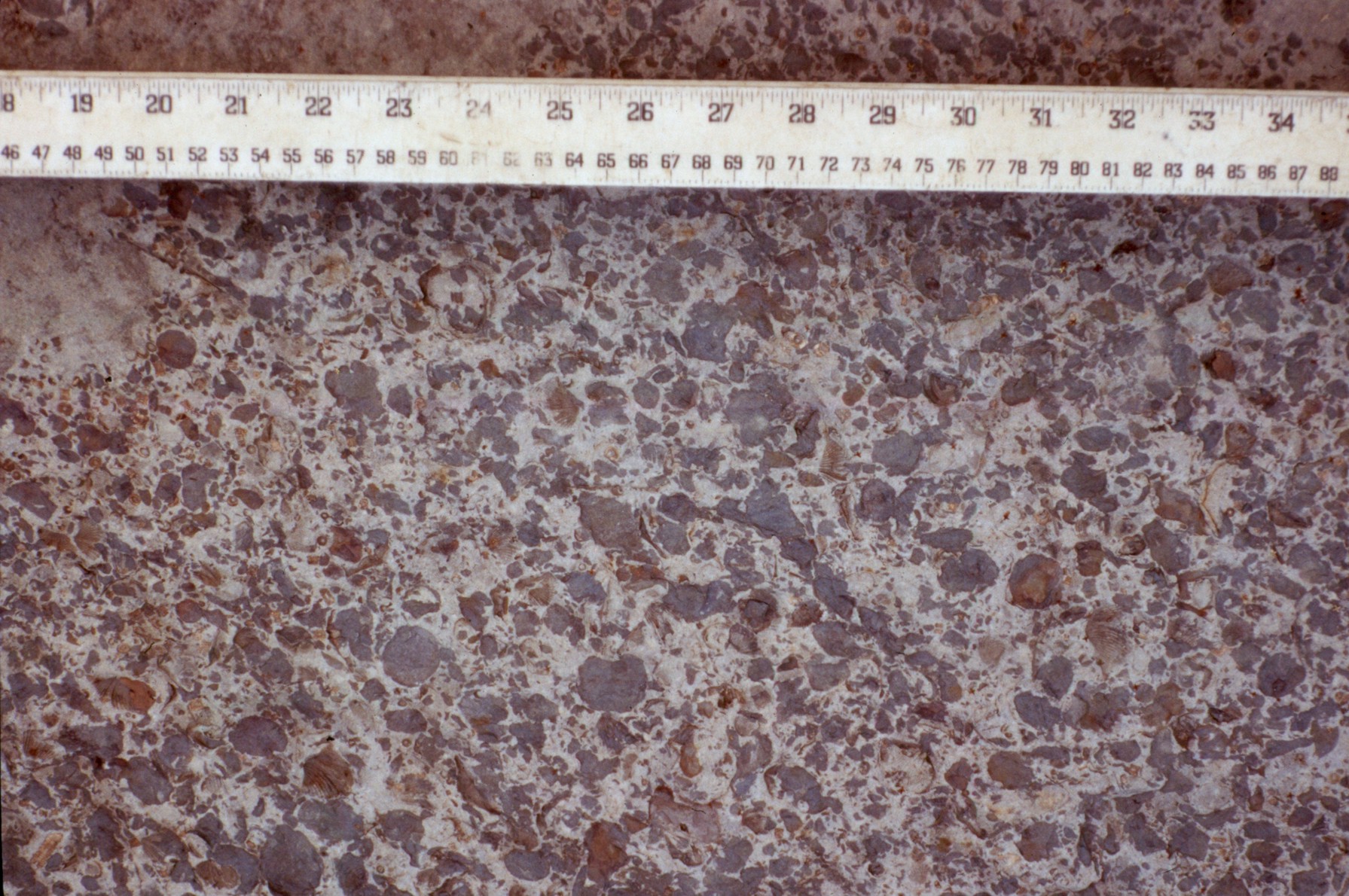
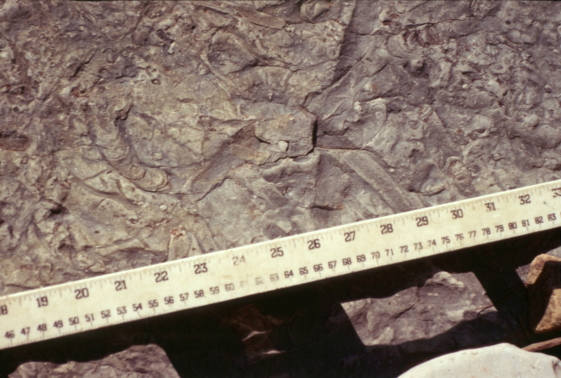
Rushford Fm., transgressive lag at White Creek contain, shell debris, cloudy white quartz
pebbles and red siltstone clasts. 4lb sledge hammer for scale.
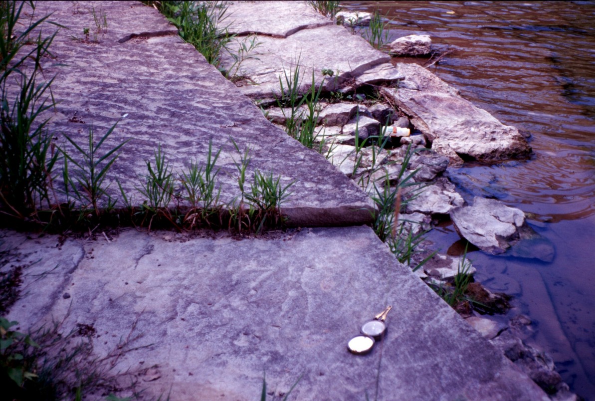
Rushford Fm., sharp, erosive contact between transgressive lag and finer-grained upper
shoreface sandstone at Baker Creek. 121 cm ruler for scale.
![]()
Transgressive lag in the Lower Sandstone Member of the Rushford Fm., seen in
outcrop along Baker Creek in the Angelica quadrangle.
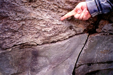
Rushford Fm., sharp, erosive contact between the transgressive lag (displaying steeply dipping cross-beds)
and the finer-grained shoreface sandstones at roadcut along Route 19. Hand is pointing to large,
white cloudy quartz pebble commonly occurring the transgressive lag deposits.
Common questions regarding the Rushford Formation concern how the sands comprising the coarser sands and larger quartz pebbles were transported far (relatively) in to the basin and preserved from erosion during subsequent transgressions and regressions.
To both questions we have looked at syndepositional activity occurring on reactivated basement faults as means to enable the capture of sediments entrained in the longshore drift, and to create a localized highland of variable accommodation space allowing thicker depositional sections to be preserved when regional sealevel further dropped and the ensuing transgressive erosion. This is similar to reactivated basement structures identified by Hart and Plint (1993) in the Cardium Fm., in Alberta and by Dorobek (1995) in the Antler Foreland Basin.
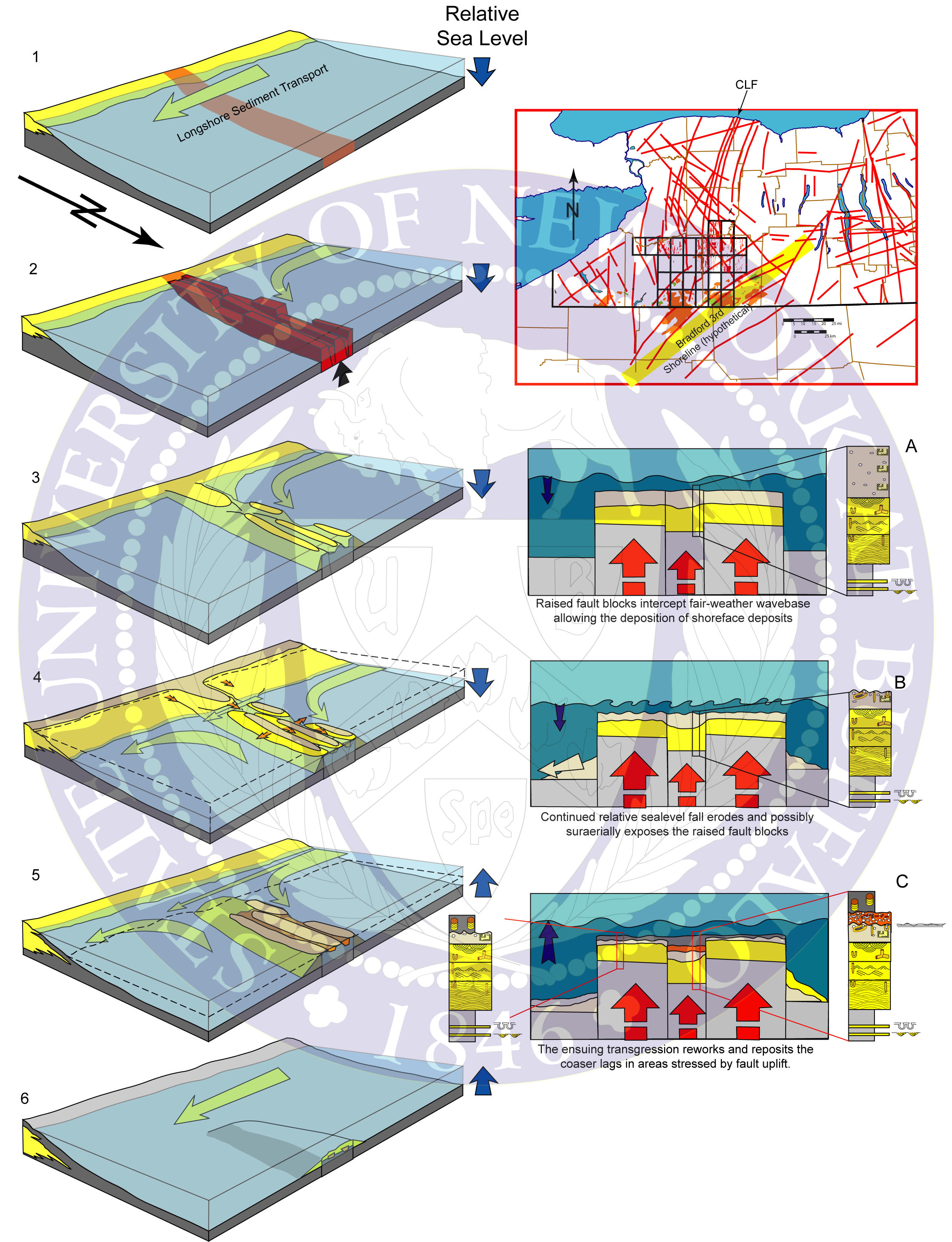
Active Faulting and Sediment Transport
For syndepositional faulting to influence regional sediment transport the active fault system strikes obliquely to the shoreline (1). During the orogeny, compression stresses reactive the fault system and the component fault blocks are uplifted forming a topographic high which intersects the shore and the longshore drift current (2). Just as a man-made groin will interrupt modern longshore currents, the fault zone would also redirect the longshore drift parallel to the fault strike and form an oblique barrier beach bar (3). As the sealevel continues to drop, subaerial and wave erosion will supply coarser sediments (4), it is also possible that erosion close to the main shoreline and longshore current will eventually erode through the fault barrier. During the ensuing transgression (5) the former fault-beach is drowned, with some erosion and reworking of finer sediments, yet still possessing a high preservation potential amongst the lower fault-block segments. The fault emplaced lowstand beach is eventually covered by the transgressive shales (6).
Active Faulting and Changes in Relative Sealevel
Regional stresses causes uplift in a fault system comprised of numerous fault segments and small fault blocks. The independent rate of uplift between individual fault blocks creates a variable accommodation space in the uplifted area forming thicker deposits in areas of higher accommodation (A). During periods of falling relative sealevel, the uplifting blocks will experience different erosional stresses, the faster rising blocks will have more sediment eroded and possibly be subaerially exposed, while the slower rising blocks with thicker accumulations of sediment will be better preserved (B). Subsequent rising of relative sealevel will further rework the uplifting areas, with the faster blocks eroding more and the slower blocks forming sediment traps for the transgressive lags (C).
Example within the Rushford Formation
The cross-section of the Lower Rushford Member below displays a variable growth fault geometry E-W. The stratigraphic sections with the thickest sediment accumulations also contain transgressive lag deposits. All stratigraphic sections exhibited transgressive erosion.
The major N-S striking faults are reactivated basement faults known to have been syndepositionally active in the Late Devonian.
Parting lineations and symmetrical ripples seen in outcrop along the Genesee River in the Angelica quadrangle.
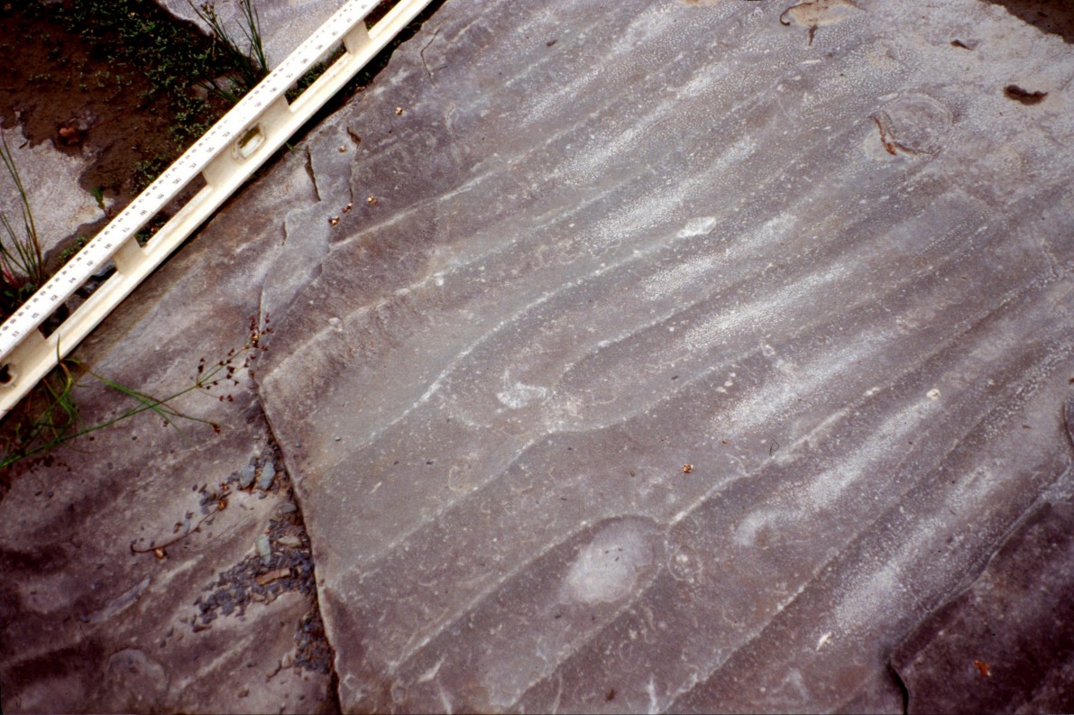
Symmetrical ripples in the Lower Sandstone Member of the Rushford Fm.
at an outcrop along White Creek, Angelica quadrangle.
Rip-up clasts within the Lower Sandstone Member of the Rushford Fm., document high energy paleoflow during deposition.
Photo taken at an outcrop is along White Creek in the Angelica quadrangle.
Outcrop of the Lower Sandstone Member of the Rushford Fm. in stream near Meadowview Rd. in the Freedom quadrangle.
Trough cross-sets overlying planar bed indicate an upper shoreface depositional environment.
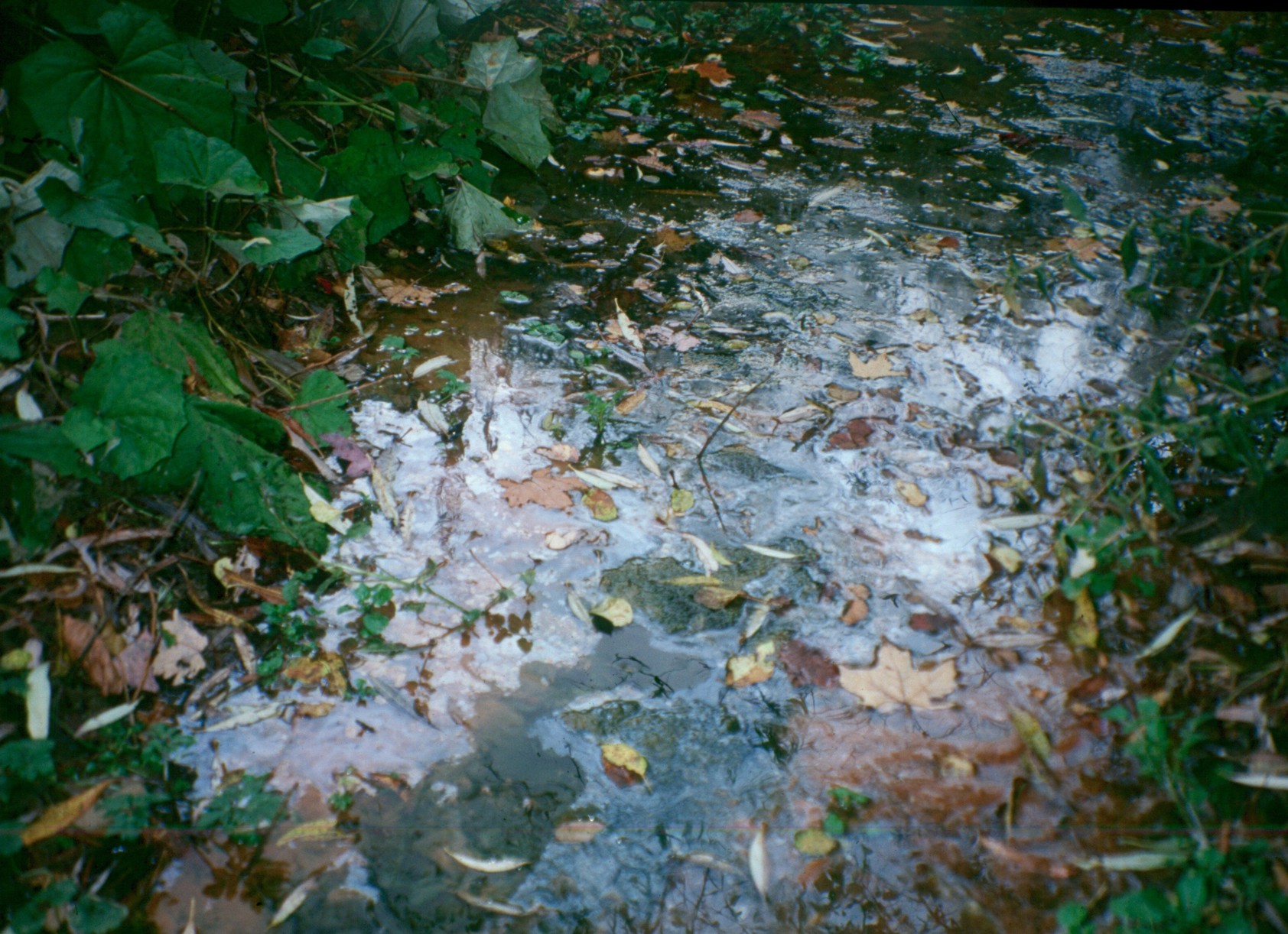
Paraffins seen in the creek above an exposure of the Rushford Fm. in the Delevan quadrangle are common along
open fractures in the Upper Devonian, once a major petroleum reservoir in the late 1800’s and early 1900’s.
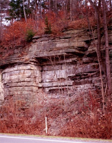
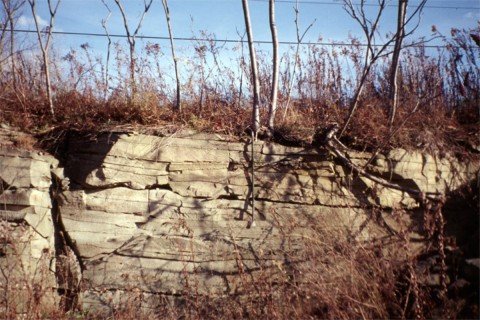
Planar laminae in an outcrop of the Rushford Fm. along Rohr Rd. in the Ellicottville quadrangle.
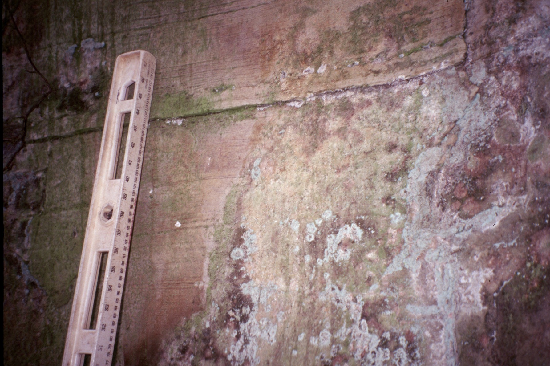
Planar laminae in an outcrop of the Rushford Fm. in an abandoned quarry in the Franklinville quadrangle.
Planar laminae in an outcrop of the Rushford Fm. in an outcrop along Hillcrest Rd. in the Houghton quadrangle.
Note the clasts of cloudy quartz scattered throughout the sandstone. The planar laminae and
occurrences of the trace fossil Macaronichnus indicate the depositional environment
for the Lower Sandstone Member was as shallow as foreshore.
The Interbedded Member of the Rushford Formation contains a robust Teichichnus ichnofacies suggesting that
the dark shales and interbedded thin sandstone beds represent a bay or lagoonal depositional environment.
Exposure of the Upper Sandstone Member of the Rushford Fm., in an outcrop in a creek near
Meadowview Rd., Freedom quadrangle. D. Zack for scale.
Roadcut exposing the upper sandstone packet of the Rushford Fm. along White Creek.
The upper sandstone packet is dominated by hummocky cross-stratification, trough cross-sets
and swaly cross-stratification. 92cm crowbar for scale.
Several episodes of deformation are shown here in a creek exposure along White Creek in Angelica quadrangle.
The soft-sediment deformation typified by the ball-and-pillow structure is surrounded by pencil cleavage
indicative of layer parallel shortening. The ball-and-pillow structure also displays later
folding and finally is offset ~5cm along a NNE fracture.
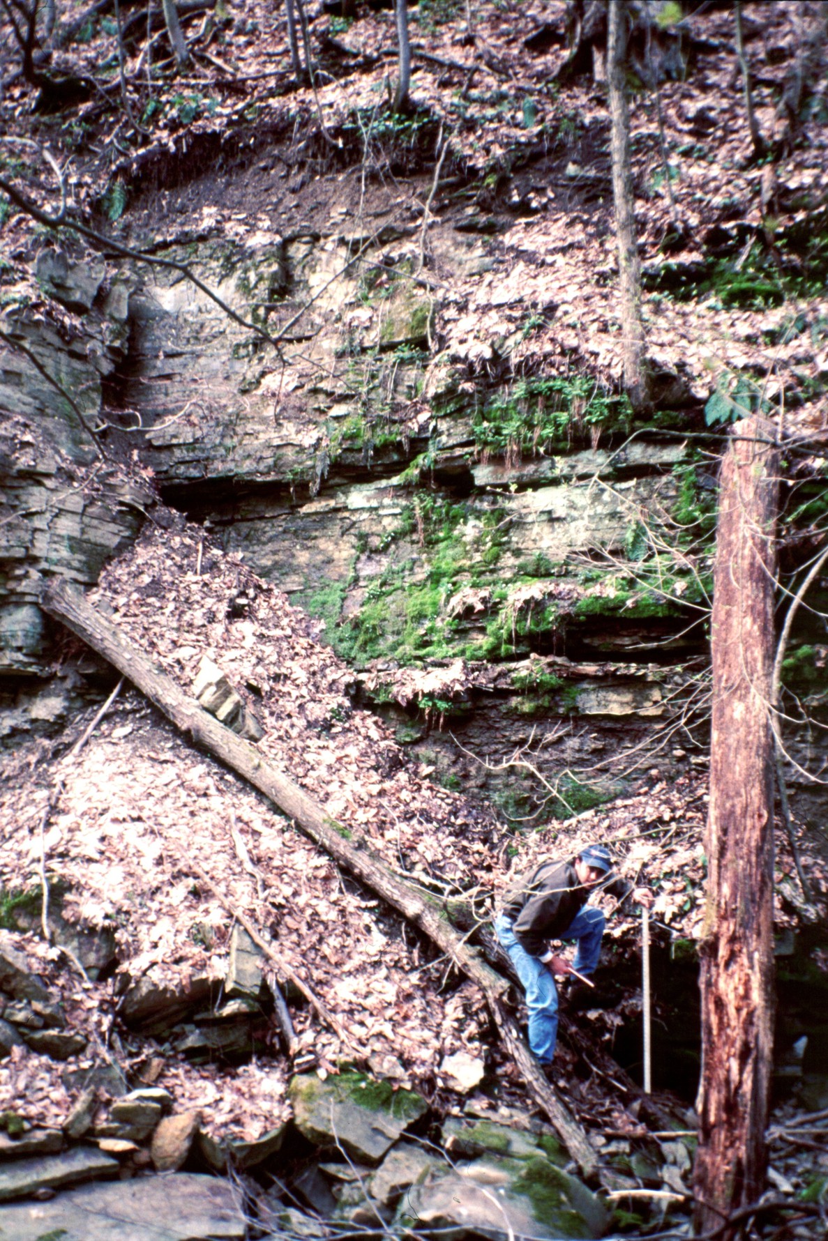
Syndepositional deformation occurring within the Lower Sandstone Member of the Rushford Fm,
at an outcrop along White Creek, Angelica quadrangle. Note that at “head” level
the sandstones are once again flat-lying. R. Bechtel for scale.