
Welcome to the GLY 103 Niagara Falls Field Trip
Figure 1. The geology of the Buffalo - Niagara Falls region remains a
fascinating subject to explore for any geologist. This fieldtrip will
provide some fundamental information to the geology of the area and
provides first-hand experience supplementary to the classroom experience,
as the rocks and geological features of the region provide an insight to
the geological history spanning several hundred million years.
A number of stops on the trip are designed to understand the geological history of the region. These include Niagara Falls, Whirlpool State Park, Devil’s Hole State Park, the Niagara River Gorge at the Power Plant Haul Road, Outwater Park Overlook over former Lake Iroquois and others based on accessibility and weather conditions.
The lithological succession in the Buffalo - Niagara Falls region spans the Upper Ordovician to Devonian time interval. The oldest exposed rocks lead us back more than four hundred and fifty million years, to a time when much of the Precambrian Shield of Paleozoic North America, called Laurentia, was submerged and covered by shallow tropical seas. A variety of rocks, sandstones, shales, carbonates were produced during this time interval and are now exposed in the Niagara Gorge. They can be interpreted as marine sediments produced in a shallow water platform region with variable water depth.
Figure 2. Schematic geological cross section through the western
end of the Lake Ontario basin to the eastern end of the Lake Erie basin,
showing the locations of the lakes relative to the southward dipping
Ordovician to Mississippian stratigraphic succession.
The Paleozoic sediments of the region are in part covered by much younger sediments representing the Pleistocene glaciation. A continental ice-shield, possibly 2-3 km thick, covered the region until about 12.500 years ago and left diverse glacial sediments, including moraines outlining the maximum extent of the glaciation. When the glaciation was finally over and the ice retreated from the Buffalo – Niagara region, isostatic uplift elevated the landscape and provided one of the main reasons for the development of the Niagara Gorge, as the river cut deeper and deeper into the raising landscape.
The Falls first developed as a water outlet draining Lake Tonawanda over the Niagara Escarpment to the north into the post-glacial Lake Iroquois, represented today by the much smaller Lake Ontario. The escarpment developed as a result of the variable hardness and erosional resistance of the Paleozoic rocks in the underground. The hard Lockport Dolomite forms the cliff-line of the Niagara Escarpment, over which the Niagara River now flows and forms the Falls. The Niagara River cut into the escarpment originally at Lockport and formed the 11.4 km long Niagara Gorge within the short time interval of 12,500 years by eroding the soft shale beneath the Lockport Dolomite, so that the destabilized cap dolomite collapsed. The erosion of the Falls is at a rate of ca. 0.5-1.0 m per year.
The Great Lakes represent the largest freshwater reservoir in the world, containing about one-fifth of all fresh water on the planet – certainly a reason for protection of the region from pollution. The Niagara River is the only outlet from the upper Great Lakes (Lake Superior, Lake Huron, Lake Erie) into Lake Ontario and from there through the St. Laurence River into the Atlantic Ocean.
Stop # 1. Goat Island, Niagara Falls.
The Horseshoe or Canadian Falls have a height of 54 m. About 5700 m3 of water drop over the Falls per second, but only about 7% of this water is diverted over the American Falls. An estimated amount of 60 tons of dissolved minerals are carried over the Falls per minute.
Figure 3. Niagara Falls in the summer. The Horseshoe Falls or Canadian
Falls seen from the US side. About 12 Million tourists visit the Falls
each year and enjoy the scenery around the second largest falls on the
globe next to the Victoria Falls in Africa.
Stop #2. The Whirlpool State Park
The Whirlpool State park shows a number of geological features, from post-glacial river terraces of the Niagara River on top of the escarpment to the buried St. David’s Gorge on the Canadian side, from the nicely exposed Ordovician – Silurian rock succession showing tectonic faulting in the Whirlpool Sandstone at the bottom of the gorge to indications of the variability of the amount of water flowing through the gorge and carving it out.
Figure 4. The entrance of the Niagara River into the Whirlpool with the
last indication of the Whirlpool Rapids. About 4.500 years ago, when the
Niagara River had eroded the gorge to this point, it intersected with the
old, buried St. David’s Gorge, carving out the glacial debris in a very
short time and forming the Whirlpool.
Stop 3#. The Devil’s Hole State Park
At one time the Devil’s Hole was one of the outlets from ancient Lake Tonawanda and a waterfall was positioned here. This has long gone, but the remaining rock formations still show the outline and extent of these falls, falling over the same escarpment as the modern Niagara Falls today only a few miles away.
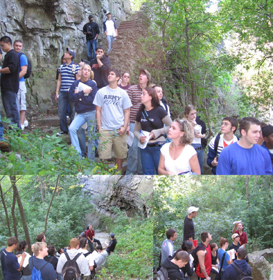
Figure 5. Devil’s Hole State Park – a waterfall gone dry.
Stop #4. Niagara River Gorge/Power Plant Haul Road
The
road exposed the rock succession from the Ordovician Queenston Shale to
the Silurian Lockport Dolomite, the caprock of Niagara Falls, and thus, it
is a perfect place to study the lithological succession of the
Paleozoic underground of western New York State. The various rock types
represent different environments from a distant past of the region, from a
beach to a carbonate platform and deeper water shale environments.
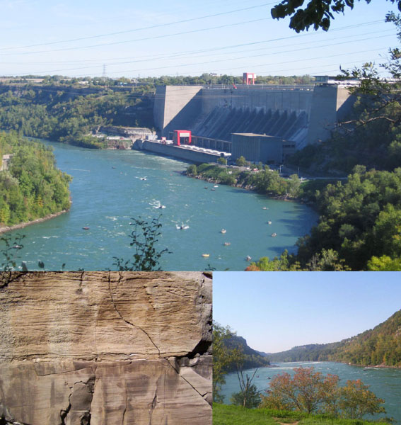
Figure 6. The Power Plant and a view into the Niagara Gorge towards the
North. The Lockport Dolomite shows some spectacular sediment structures
and bears numerous fossils.
Stop # 5. Iroquois Beach Ridge
This is not a real stop, as we drive east on route 104 along an ancient beach ridge of post-glacial Lake Iroquois. The wide plain to the north are formed by the old lake bottom of Lake Iroquois, a larger version of modern Lake Ontario.
Stop #6. Gulf and Waste Water Treatment Plant, Lockport
This locality exposes a thinner section of the late Ordovician to Silurian successsion we have already seen in the Niagara River Gorge. Here the rocks are easily accessible and with a little luck numerous fossils can be collected from the Grimsby Sandstone.
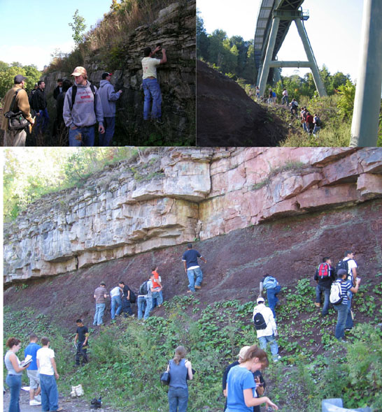
Figure 7. A dramatic exposure of the red Queenston Shale (Ordovician) and
the white Whirlpool, Sandstone (Silurian). The base of the sandstone shows
mudcracks indicating an erosional surface – an unconformity of
considerable impact.
Stop #7. Outwater Park Overlook, Lockport
The Outwater Overlook gives us a last impression of the glaciation as we look over the plain north of the Niagara Escarpment and notice Lake Ontario in the distance. The surface of the Lockport Dolomite is here scarred by glacial striations and polished to show numerous fossils, including corals, stromatolites, bryozoans, crinoids and others.

Figure 8. The end of the trip.
GLY 103: Exploring the Solar System I, Introduction to Geology (w/Lab)